A scaffolding contract for a single commercial roof inspection in the UK can cost more than an entire drone survey programme for the same building, yet thousands of practices still default to traditional access methods. The gap between what drone surveys and 3D scanning now deliver and what many surveyors believe they can deliver has never been wider.
This guide examines how drone surveys and 3D scanning in UK building inspections deliver measurable value in terms of costs, accuracy and ROI for surveyors, covering the regulatory landscape that changed on 1 January 2026, typical pricing benchmarks, accuracy comparisons against traditional methods, and the practical return on investment for small and medium surveying practices.
Key Takeaways
- Since January 2026, UK drone operators must comply with new class-marking and Remote ID rules; GVC-qualified pilots using calibrated equipment now produce imagery accepted as formal Building Control evidence.
- Typical UK drone survey costs range from approximately £300 for a basic residential roof inspection to over £3,500 for complex thermal or LiDAR surveys on large commercial assets.
- With correctly placed ground control points, photogrammetric 3D models achieve centimetre-level positional accuracy suitable for topographic mapping and detailed building measurement.
- The ROI case rests on eliminating scaffolding costs, reducing inspection time, minimising working-at-height risks, and unlocking new service lines for practices of all sizes.
- Regulatory compliance requires CAA Operator ID registration, appropriate Flyer IDs, class-marked aircraft, and third-party liability insurance aligned with EC785/2004.
How Drone Surveys and 3D Scanning Fit Into UK Building Inspections
The integration of drone surveys and 3D scanning in UK building inspections has moved from novelty to standard practice across a wide range of survey types. Drones now support roof condition assessments, facade inspections, topographic surveys, thermal imaging, and post-construction verification, all areas where traditional access methods create cost, time, and safety challenges.
Common use cases for UK surveyors in 2026 include:
- Residential and commercial roof surveys for defect identification
- Facade inspections on high-rise or heritage buildings
- Topographic and boundary surveys tied to Ordnance Survey coordinates
- Thermal building envelope assessments for energy performance and moisture ingress
- Post-construction photogrammetric models for Building Control sign-off
- Infrastructure corridor surveys for utilities and highways
RICS guidance on drones for surveyors stresses that aerial surveys must begin from a geo-referenced digital file of the area of interest and must follow CAA regulations throughout the operation and data handling process [2][3]. The "Earth observation and aerial surveys" global guidance note reinforces that airborne laser scanning and photogrammetric surveys require the same rigorous data quality standards as ground-based methods [6].
GeoAI, the application of artificial intelligence to geospatial data, is increasingly layered on top of drone-captured datasets. Point clouds from LiDAR scans and photogrammetric models generated by software such as Pix4Dcapture or DroneDeploy are now processed with machine-learning tools that can automatically classify defects, flag anomalies in thermal imagery, and generate condition scores without manual review of every frame. For small and medium practices, this means faster report turnaround and the ability to handle larger inspection volumes without proportional increases in staff time.
The 2026 Regulatory Framework Every Surveyor Must Know
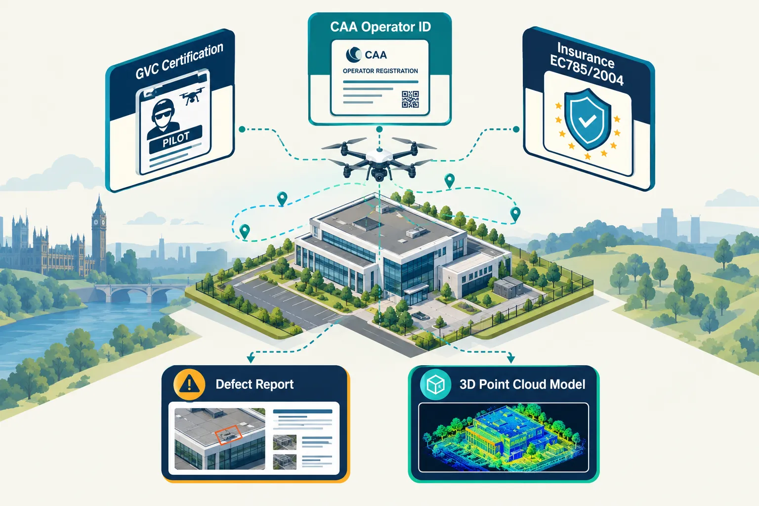
Since 1 January 2026, UK commercial building inspections using drones must comply with updated class-marking and Remote ID requirements. Professional operators are expected to hold a General Visual Line of Sight Certificate (GVC) and a CAA-issued Operator ID. Compliant imagery captured by certified pilots using calibrated equipment is now widely accepted as official evidence for Building Control sign-off [1].
The CAA categorises most building survey work under the Open Category, which requires:
- Operator registration (approximately £10.33 per year)
- A personal Flyer ID obtained through the CAA online theory test
- Third-party liability insurance compliant with EC785/2004
- Operations below 120 metres altitude within visual line of sight
C0 and C1 drones can be used relatively freely in public spaces, while C2 drones typically require an A2 Certificate of Competence (A2 CofC). Close-proximity building inspections and infrastructure assessments often require Specific Category authorisations backed by detailed operational risk assessments [8][10].
For beyond visual line of sight (BVLOS) operations, relevant for large industrial sites, perimeter surveys, or corridor inspections, the CAA's October 2024 policy on atypical air environments has made infrastructure inspections more accessible, signalling a clear trajectory toward longer-range automated inspection flights [4].
Regulatory note: Surveyors commissioning third-party drone operators should verify GVC qualification, current CAA Operator ID, appropriate class-marked aircraft, and evidence of calibrated imaging workflows before accepting outputs as formal inspection evidence [1].
Costs, Accuracy and ROI for Surveyors Using Drone and 3D Scanning Technology
Understanding the cost structure of drone surveys and 3D scanning in UK building inspections is essential for surveyors building a business case, whether commissioning external operators or investing in in-house capability.
Typical UK Drone Survey Pricing (2026)
The following ranges reflect current market rates for professional drone survey services in the UK:
| Survey Type | Typical Cost Range |
|---|---|
| Basic residential roof photography | £300, £700 |
| Standard commercial roof inspection | £600, £1,500 |
| Small-to-medium photogrammetric topographic survey | £800, £1,800 |
| Larger site with contour maps and CAD-ready exports | £2,000, £4,000 |
| LiDAR survey on complex or corridor sites | £1,200, £3,000+ |
| Thermal survey on large commercial or industrial assets | £1,200, £3,500+ |
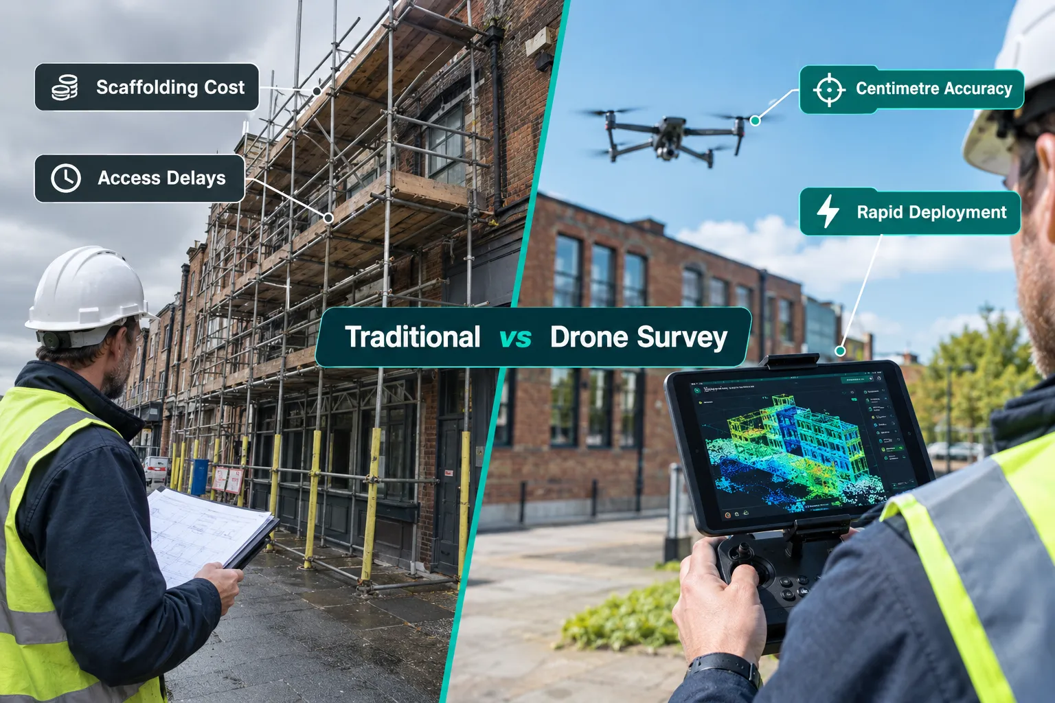
These figures should be compared against the cost of scaffolding, which for a standard two-storey commercial building can range from £3,000 to over £10,000 depending on building height, access complexity, and hire duration. When downtime, health and safety management, and programme delays are factored in, the cost differential becomes substantial [12].
Accuracy: Drone Photogrammetry and LiDAR vs Traditional Methods
Accuracy is the most common concern raised by surveyors considering drone-based methods. The evidence is now well established.
Photogrammetric 3D models produced using automated flight planning software such as DJI Pilot 2, Pix4Dcapture, or DroneDeploy, combined with surveyed ground control points (GCPs) tied to Ordnance Survey coordinates, routinely achieve centimetre-level positional accuracy. This is sufficient for topographic mapping, detailed building measurement, and dimensional verification [8][6].
LiDAR scanning from drones produces dense point clouds with sub-centimetre precision on complex geometries, making it the preferred method for heritage buildings, irregular facades, and sites where photogrammetry struggles with low-texture surfaces.
Thermal imaging accuracy depends on environmental conditions. UK guidance recommends conducting thermal drone inspections between November and March to maximise the temperature differential between internal and external environments, improving the reliability of heat loss, insulation defect, and moisture ingress identification [9].
Compared with traditional methods:
- Manual tape measurements introduce cumulative errors and cannot capture full-facade geometry efficiently
- Total station surveys are highly accurate but slow and require unobstructed line of sight
- Drone photogrammetry with GCPs matches or exceeds total station accuracy for large-area surveys at a fraction of the time cost
- LiDAR point clouds provide richer spatial data than any manual method for complex structures
Calculating ROI for Small and Medium Practices
The ROI case for drone surveys and 3D scanning in UK building inspections operates on several dimensions simultaneously.
Direct cost savings:
Eliminating or reducing scaffolding on a single commercial inspection can save £3,000 to £8,000. For a practice conducting 20 commercial inspections per year, this represents a potential saving of £60,000 to £160,000 annually in access costs alone.
Time efficiency:
A drone can capture a complete commercial roof survey in under two hours, including flight planning and data capture. Processing photogrammetric models typically adds two to four hours of office time. A comparable scaffold-based inspection may require two to three days of on-site access plus mobilisation time.
Risk reduction:
Working at height remains one of the most significant causes of serious injury in the UK construction and surveying sectors. Drone inspections remove the need for surveyors and technicians to access dangerous areas, reducing liability exposure and insurance costs over time [12].
New service lines:
Practices that develop drone and 3D scanning capability can offer thermal energy assessments, pre-purchase aerial condition reports, and photogrammetric as-built surveys, services that command premium fees and differentiate the practice in a competitive market.
In-house vs commissioned:
For practices conducting fewer than 15 to 20 drone surveys per year, commissioning a qualified external operator is typically more cost-effective than purchasing equipment, obtaining GVC qualification, and maintaining CAA authorisation. Above that threshold, in-house capability generally becomes financially justified, particularly when the practice can absorb the training time and regulatory overhead.
Regulatory Compliance, Insurance and Workflow Standards for UK Drone Surveys
Meeting the regulatory requirements for drone surveys and 3D scanning in UK building inspections is not optional, it is the foundation on which the ROI case rests. Non-compliant surveys produce outputs that cannot be used as formal evidence, undermining the entire investment [1][7].
Step-by-Step Compliance Workflow
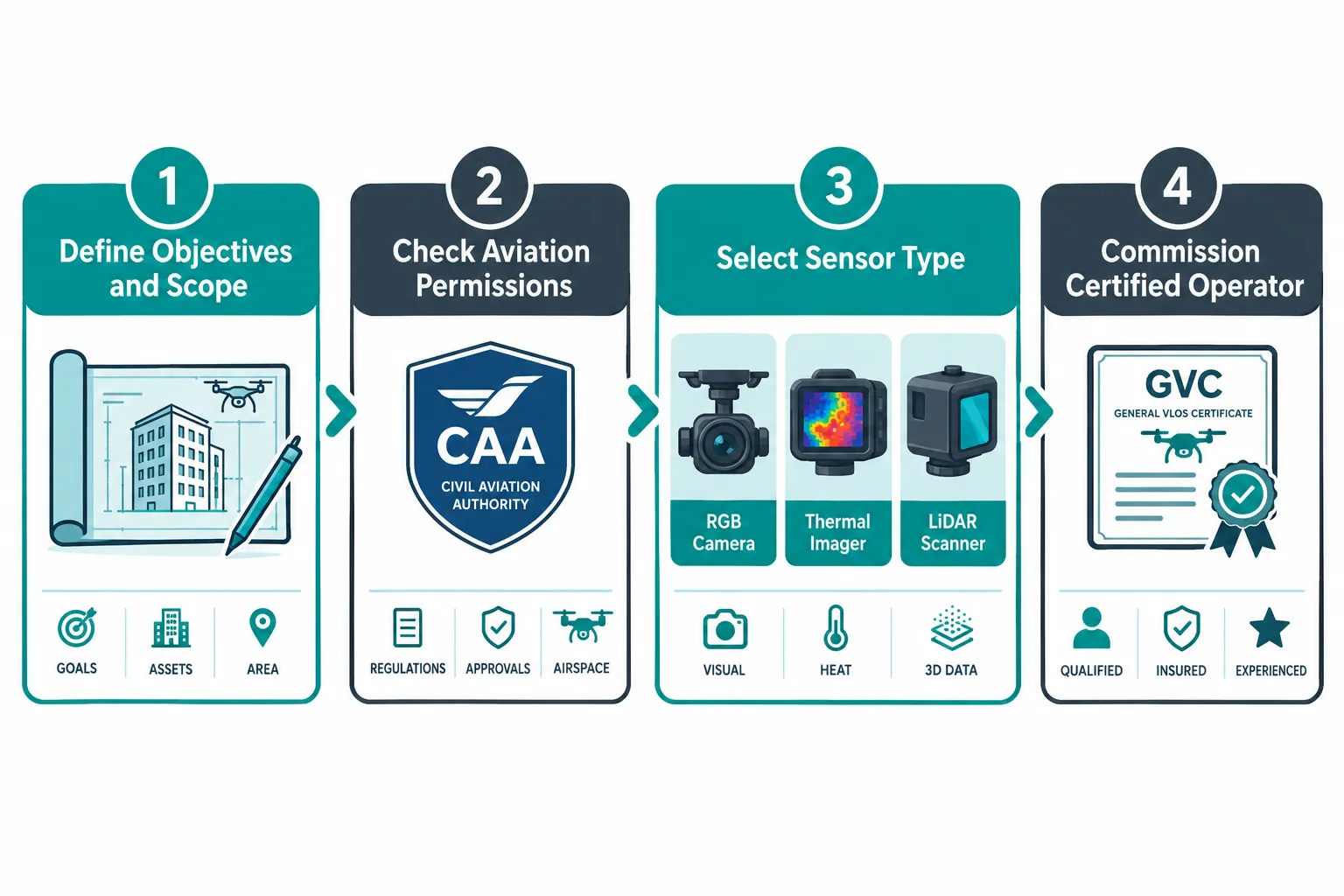
A mature, standardised workflow for UK drone building inspections follows four core stages [5]:
- Define inspection objectives and building scope, identify what data is needed, at what accuracy, and for what purpose (condition report, Building Control evidence, thermal assessment, topographic survey).
- Check aviation permissions and site risks, confirm CAA category, airspace restrictions, proximity to aerodromes, and any Specific Category authorisation requirements; prepare an operational risk assessment where needed.
- Select the appropriate sensor, RGB camera for photogrammetry and condition reports; thermal camera for energy and moisture surveys; LiDAR for high-accuracy 3D scanning on complex structures.
- Commission or deploy a certified operator, verify GVC qualification, Operator ID, class-marked aircraft, calibrated imaging workflow, and appropriate insurance.
Insurance Requirements
All commercial drone operations in the UK require third-party liability insurance compliant with EC785/2004. This is a legal requirement, not a recommendation. Surveyors commissioning external operators should request evidence of current insurance before accepting any deliverable intended for use as formal survey evidence [8][10].
Practices operating in-house should review their professional indemnity insurance to confirm that drone-based survey outputs are covered under existing policy terms, as some insurers treat aerial data capture as a specialist activity requiring endorsement.
Data Handling and Geo-Referencing Standards
RICS guidance is explicit that drone and aerial surveys must start from a geo-referenced digital file of the area of interest [2][3][6]. In practice, this means:
- GCPs must be surveyed using GNSS equipment tied to Ordnance Survey National Grid coordinates
- Point cloud and photogrammetric model outputs must carry coordinate metadata enabling integration with CAD, GIS, and BIM platforms
- Raw imagery and processed models should be retained in accordance with the commissioning client's data retention policy and any relevant planning or Building Control requirements
Outputs that lack proper geo-referencing cannot be reliably integrated with existing site data, reducing their value and potentially invalidating their use as formal evidence.
Thermal Surveys: Timing and Notification
Thermal drone building inspections are most effective between November and March, when the temperature differential between heated interiors and cold exteriors is greatest [9]. This seasonal constraint is important for practices planning inspection programmes.
For standard thermal operations, notification to local councils is generally not required. However, operations in controlled airspace, near aerodromes, or above densely populated areas may require additional permissions regardless of the survey type.
Conclusion
The evidence for adopting drone surveys and 3D scanning in UK building inspections is now compelling across cost, accuracy, and regulatory dimensions. The 2026 regulatory framework has clarified what compliance looks like, making it easier for surveyors to commission or conduct drone surveys with confidence that outputs will be accepted as formal evidence.
Actionable next steps for surveyors and practices:
- Audit current inspection costs, calculate the scaffolding, access, and programme costs across last year's commercial inspection portfolio to establish a baseline for ROI comparison.
- Verify operator credentials, before commissioning any drone survey, confirm GVC qualification, CAA Operator ID, class-marked aircraft, and EC785/2004-compliant insurance.
- Engage with RICS guidance, review the RICS practice information on drones and the Earth observation and aerial surveys global guidance note to align internal workflows with professional standards.
- Plan thermal surveys seasonally, schedule thermal building envelope assessments for the November-to-March window to maximise data quality and defect detection reliability.
- Assess the in-house threshold, if the practice conducts more than 15 to 20 drone surveys annually, model the cost of in-house GVC training, equipment, and CAA registration against the ongoing cost of commissioning external operators.
- Explore GeoAI integration, investigate point cloud processing and AI-assisted defect classification tools that can reduce post-processing time and increase report throughput without additional headcount.
The practices that build structured, compliant drone and 3D scanning workflows now will be best positioned to compete on quality, speed, and safety as client expectations continue to rise.
References
[1] Drone Inspection For Building Regulations A Guide To Compliance In 2026 – impactaerial.co.uk
[2] Drones Applications And Compliance For Surveyors – rics.org
[3] Drones Applications And Compliance For Surveyors Rics – rics.org
[4] Infrastructure Inspections With Drones Made Easier Under New Rules – caa.co.uk
[5] Drone Survey Uk – visualperspectives.co.uk
[6] Earth Observation And Aerial Surveys Reissue Jan 2023 – rics.org
[7] Drone Survey Regulations Overview Uk 2026 – mmoww.net
[8] Drone Property Survey Uk 2026 – mmoww.net
[9] Thermal Drone Building Inspections Uk 2026 Guide – impactaerial.co.uk
[10] Basic Rules For Drones – hq.surveyors-uk.com