
}
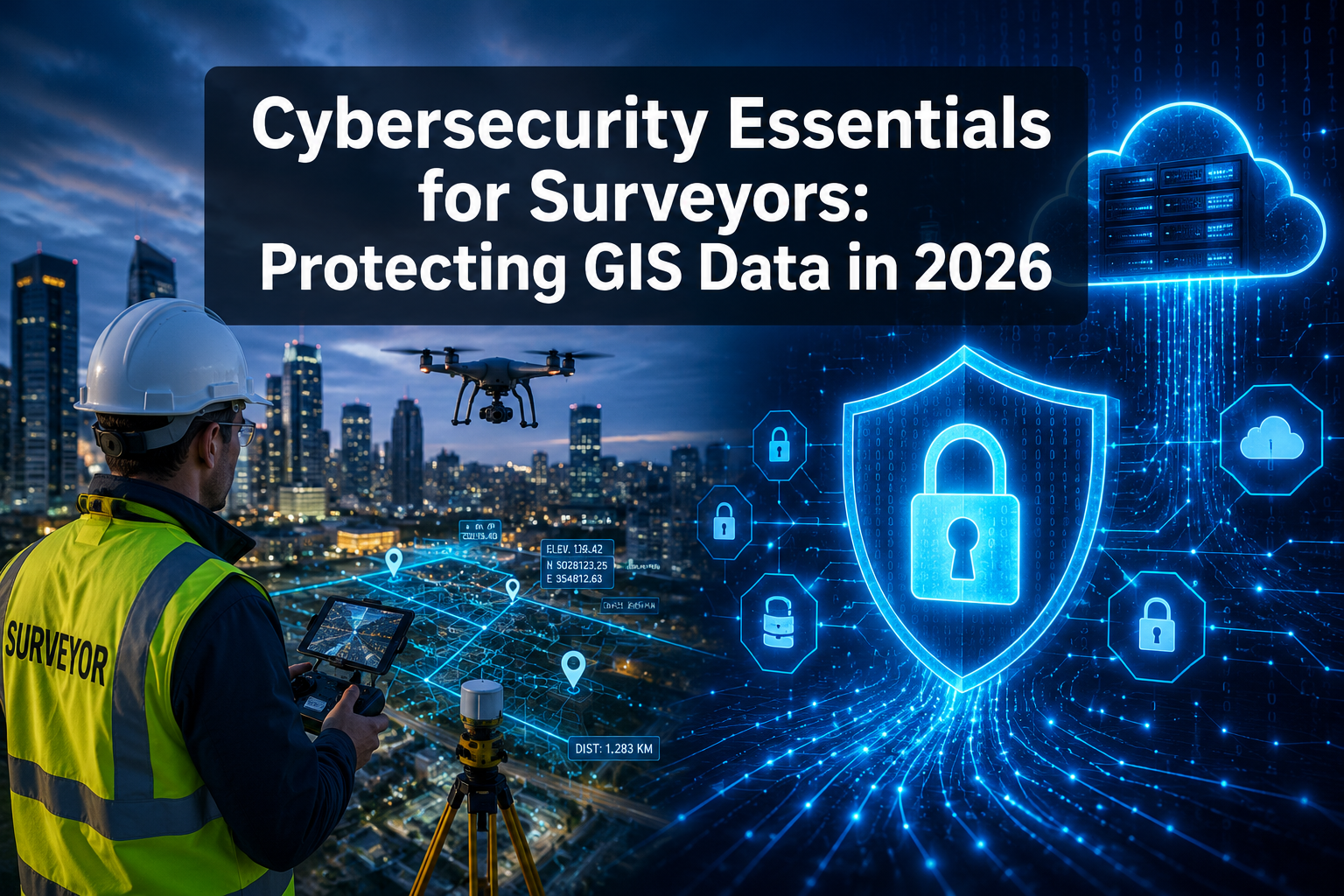
43% of UK businesses reported a cyberattack or breach in the past 12 months — yet the surveying sector, which handles some of the most sensitive spatial, structural, and financial data in the built environment, remains dangerously under-prepared [9]. As drone surveys, cloud-hosted GIS platforms, and BIM file sharing become standard practice, the attack surface for surveying firms has expanded dramatically. Cybersecurity Essentials for Surveyors: Protecting GIS Data and Cloud-Based Survey Deliverables in 2026 is no longer a niche IT concern — it is a professional obligation.

Key Takeaways 📌
- Cyber threats targeting surveying data are rising fast — GIS files, drone-captured point clouds, and BIM deliverables are high-value targets.
- Cyber Essentials Plus (CE+) 2026 "Danzell" update now pulls cloud services, identity providers, and SaaS portals directly into audit scope.
- Mandatory multi-factor authentication (MFA) across all cloud users is becoming a hard compliance requirement, not optional best practice.
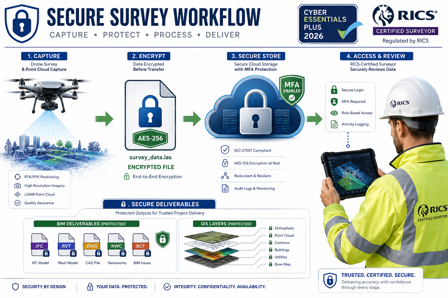
- Encryption of drone-captured data and BIM files must happen at the point of capture, not just in storage.
- A structured compliance checklist — covering access controls, encryption, incident response, and staff training — is the fastest path to defensible protection.
Why Surveyors Are Now Prime Cyber Targets
Surveying firms were once considered low-priority targets for cybercriminals. That assumption is dangerously outdated.
Modern surveying practices generate enormous volumes of sensitive data: precise geospatial coordinates, structural defect reports, property valuations, client financial information, and legal boundary data. A single homebuyer survey file can contain enough personally identifiable information (PII) and property intelligence to enable fraud, identity theft, or targeted physical crime.
The shift to cloud-based workflows has amplified this risk. Consider what now lives in the cloud for a typical surveying firm:
| Data Type | Risk Level | Common Cloud Location |
|---|---|---|
| GIS mapping layers | 🔴 High | ArcGIS Online, QGIS Cloud |
| Drone-captured point clouds | 🔴 High | AWS S3, Azure Blob |
| BIM/IFC project files | 🔴 High | Autodesk Construction Cloud |
| Structural survey reports | 🟠 Medium-High | SharePoint, Google Drive |
| Client contact & financial data | 🔴 High | CRM platforms, email |
| Schedule of condition reports | 🟠 Medium | Project portals |
The World Economic Forum's Global Cybersecurity Outlook 2026 confirms that cyber inequality is widening — smaller professional services firms, including surveying practices, lack the security maturity of large enterprises but hold equally sensitive data [8]. This makes them attractive, soft targets.
💬 "The question is no longer whether a surveying firm will face a cyber incident — it's whether they'll be ready when it happens."
Ransomware attacks on professional services firms increased significantly heading into 2026, with attackers specifically targeting firms that handle property, legal, and financial data [2]. For surveyors operating across locations — whether chartered surveyors in London or regional practices across the UK — the threat is consistent and growing.
Understanding the 2026 Threat Landscape for GIS and Survey Data
The Drone Data Problem 🚁
Drone surveys have transformed how surveyors capture site data — but they've also introduced a new category of cybersecurity risk that most firms haven't addressed.
Drone-captured data — including RGB imagery, LiDAR point clouds, thermal scans, and photogrammetric models — is typically:
- Stored temporarily on SD cards or internal drone memory (unencrypted)
- Transferred via USB or Wi-Fi to a field laptop (often unsecured)
- Uploaded to a cloud processing platform (sometimes without end-to-end encryption)
- Shared with clients via download links (frequently without access controls)
Each of these steps is a potential breach point. A stolen field laptop containing unencrypted drone imagery of a critical infrastructure site is not just a data loss — it's a national security concern.
Best practice for drone data security in 2026:
- Enable AES-256 encryption on all storage media from the point of capture
- Use VPN-secured transfers when uploading from field devices
- Apply role-based access controls (RBAC) on cloud processing platforms
- Set expiry dates on client download links — never use permanent share links
- Maintain a data inventory log for every drone flight
BIM File Security: The Hidden Vulnerability
Building Information Modelling (BIM) files represent years of design, structural, and spatial intelligence. For commercial building surveys and large-scale projects, a single BIM model can contain:
- Precise structural specifications
- MEP (mechanical, electrical, plumbing) system layouts
- Security system placements
- Access point locations
This data, in the wrong hands, could enable targeted physical attacks on buildings or infrastructure. Yet many surveying firms share BIM files via standard email attachments or unprotected cloud folders.
BIM security essentials:
- Store BIM files in ISO 19650-compliant Common Data Environments (CDEs)
- Enforce federated model access — users see only the layers they need
- Apply digital watermarking to track unauthorised distribution
- Conduct regular access reviews to remove former project collaborators
Ransomware and Phishing: The Most Common Attack Vectors
According to the UK Government's Cyber Security Breaches Survey 2025/2026, phishing remains the most common attack vector for UK businesses, with ransomware incidents causing the most severe financial damage [9]. For surveyors, a successful phishing attack on a project manager's email account could expose every client file, survey deliverable, and GIS dataset in a shared drive.
Cybersecurity best practices for 2026 emphasise zero-trust architecture — the principle that no user, device, or network should be trusted by default, even inside the organisation [2]. This is especially relevant for surveying firms with remote field teams accessing cloud systems from varied locations and devices.
Cybersecurity Essentials for Surveyors: Protecting GIS Data and Cloud-Based Survey Deliverables in 2026 — Core Protocols
The Cyber Essentials Plus 2026 "Danzell" Update: What Surveyors Must Know
The most significant regulatory development for UK surveying firms in 2026 is the Cyber Essentials Plus (CE+) "Danzell" update, effective for assessments created on or after 27 April 2026 [1].
This update fundamentally changes what auditors look for:
Old approach: Policy documents and self-attestation
New approach: Real technical evidence that controls are working
Auditors now must:
- Inspect live systems, logs, and device configurations
- Re-sample devices during remediation to confirm controls are applied organisation-wide
- Verify that cloud services and identity configurations meet the same standard as on-premises servers [1]
🔑 For surveyors using cloud GIS, VPNs, field laptops, tablets, or SaaS project portals — these systems now fall explicitly in scope under CE+ 2026.
This means a surveying firm's Azure AD/Entra ID or Google Workspace identity configuration, its GIS hosting environment, and its cloud storage for survey deliverables must all meet CE+ standards. Firms handling UK public-sector work or framework contracts will likely face CE+ as a contractual requirement.
Mandatory MFA: No Longer Optional
Multi-factor authentication (MFA) across all cloud users is rapidly becoming a hard requirement under CE+ 2026 and broader industry standards [1][2]. For surveying firms, this means:
- Every user accessing cloud GIS platforms must authenticate with MFA
- Field staff using tablets or mobile devices are not exempt
- Service accounts and API integrations must use certificate-based or token-based authentication
- Phishing-resistant MFA (e.g., FIDO2/passkeys) is preferred over SMS-based codes
The PwC 2026 Cybersecurity Outlook confirms that identity-based attacks are the leading threat vector for professional services firms, making MFA the single highest-return security investment available [3].
Encryption Standards for Survey Deliverables
| Data State | Minimum Standard | Recommended Standard |
|---|---|---|
| Data at rest (cloud storage) | AES-128 | AES-256 |
| Data in transit | TLS 1.2 | TLS 1.3 |
| Field device storage | BitLocker/FileVault | Hardware-encrypted SSD + BitLocker |
| Client deliverable sharing | Password-protected PDF | Encrypted portal with MFA |
| Email attachments | Avoid for sensitive files | Secure file transfer portal |
For firms conducting monitoring surveys or structural surveys involving critical infrastructure, these encryption standards should be considered the absolute minimum.
Compliance Checklist for Surveyors: Cybersecurity Essentials for Surveyors Protecting GIS Data and Cloud-Based Survey Deliverables in 2026
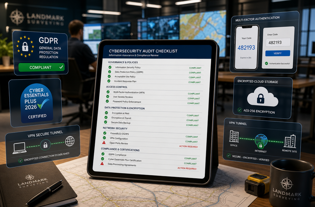
Use this checklist to assess and strengthen your firm's cybersecurity posture. This framework aligns with CE+ 2026, GDPR, and NCSC guidance [1][4][9].
✅ Access Control & Identity
- MFA enabled for all cloud platform users (no exceptions)
- Role-based access controls (RBAC) applied to GIS platforms and project portals
- Privileged accounts (admin) separated from standard user accounts
- Joiners/movers/leavers process in place — access revoked within 24 hours of departure
- Regular access reviews conducted (minimum quarterly)
- Password manager deployed firm-wide with minimum 16-character unique passwords
✅ Device & Endpoint Security
- All field laptops and tablets enrolled in Mobile Device Management (MDM)
- Full-disk encryption enabled on all devices (BitLocker for Windows, FileVault for Mac)
- Automatic screen lock set to 5 minutes or less
- Remote wipe capability enabled for all mobile devices
- Antimalware software installed and auto-updating on all endpoints
- USB port restrictions applied to prevent unauthorised data transfer
✅ Cloud & GIS Platform Security
- Cloud storage buckets/containers set to private by default
- No publicly accessible GIS data layers without explicit authorisation
- Cloud identity provider (Azure AD/Google Workspace) configured to CE+ 2026 standards [1]
- Conditional access policies applied (block access from non-compliant devices)
- Data retention and deletion policies documented and enforced
- Regular cloud configuration audits scheduled (minimum bi-annual)
✅ Drone Data & Field Operations
- Encrypted storage media used for all drone operations
- Field device VPN mandatory when transferring data
- Drone flight logs and data inventories maintained
- Client-facing download links set with expiry dates and access logging
- Drone firmware kept up to date (vulnerabilities in older firmware are well-documented)
✅ Incident Response
- Written incident response plan in place and tested annually
- ICO breach notification process understood (72-hour GDPR requirement)
- Offline/immutable backups of critical data maintained (3-2-1 backup rule)
- Cyber insurance policy reviewed and adequate for data breach scenarios
- Staff know who to contact internally if they suspect a breach
✅ Staff Training & Culture
- Annual cybersecurity awareness training for all staff [7]
- Phishing simulation exercises conducted (minimum twice yearly)
- Clear policy on use of personal devices for work (BYOD policy)
- Secure file sharing procedures documented and communicated
- New staff receive cybersecurity induction within first week
Practical Security for Specific Survey Types
Different survey types carry different risk profiles. Here's how cybersecurity considerations apply across common surveying activities:
Structural surveys — Reports often contain detailed information about building weaknesses. Store and share via encrypted portals only.
Dilapidation surveys — Involve legally sensitive data with commercial implications. Apply strict access controls and audit trails.
Schedule of condition reporting — Photographic evidence requires secure storage with metadata stripped before client delivery to avoid location data exposure.
Commercial property surveying — Often involves multiple stakeholders. Federated access controls and watermarked deliverables are essential.
Asbestos surveys — Reports are legally required documents. Ensure immutable backups and tamper-evident storage.
Building a Cyber-Resilient Surveying Practice
The must-have cybersecurity tools for surveying firms in 2026 include [10]:
- Endpoint Detection & Response (EDR) — Goes beyond antivirus to detect and respond to threats in real time
- SIEM (Security Information & Event Management) — Aggregates logs from cloud platforms, devices, and networks for threat detection
- Privileged Access Management (PAM) — Controls and audits use of admin accounts
- Secure File Transfer platforms — Replaces email for sensitive deliverable sharing
- Cloud Security Posture Management (CSPM) — Continuously monitors cloud configurations for misconfigurations
For smaller surveying practices, the priority should be: MFA first, encryption second, staff training third. These three measures address the vast majority of real-world attack scenarios at manageable cost.
The SANS Security Awareness Summit 2026 reinforces that human error remains the leading cause of breaches — making staff training not a compliance checkbox but a genuine risk-reduction investment [7].
Conclusion: Actionable Next Steps for Surveyors in 2026
Cybersecurity Essentials for Surveyors: Protecting GIS Data and Cloud-Based Survey Deliverables in 2026 demands immediate, practical action — not just policy documents. The CE+ 2026 "Danzell" update has made technical proof of protection mandatory, and the threat landscape has evolved far beyond what basic antivirus software can address [1].
Your immediate action plan:
- Conduct a cloud audit this week — identify every platform holding GIS or survey data, check access controls and MFA status
- Enable MFA on all cloud accounts — prioritise GIS platforms, project portals, and email
- Encrypt all field devices — BitLocker or FileVault, no exceptions
- Run a phishing simulation — understand where your team's weaknesses are before attackers do
- Review your CE+ readiness — if you handle public-sector work, the April 2026 "Danzell" requirements are not optional
- Document an incident response plan — even a one-page plan is better than none
- Brief your team — cybersecurity is everyone's responsibility, not just the IT manager's
The surveying profession handles data that shapes how cities are built, how properties are valued, and how infrastructure is maintained. Protecting that data is not just a regulatory obligation — it is a professional duty. The firms that treat cybersecurity as a core competency in 2026 will be the ones clients trust with their most sensitive projects.
References
[1] Cyber Essentials Plus 2026 Compliance – https://blog.qualys.com/product-tech/2026/03/02/cyber-essentials-plus-2026-compliance
[2] Cybersecurity Best Practices For 2026 – https://www.scribd.com/document/992789019/Cybersecurity-Best-Practices-for-2026
[3] 2026 Cybersecurity Outlook – https://www.pwc.com/us/en/services/consulting/cybersecurity-data-tech-risk/library/2026-cybersecurity-outlook.html
[4] Cybersecurity Basics Courts – https://www.ncsc.org/resources-courts/cybersecurity-basics-courts
[7] Security Awareness Summit 2026 – https://www.sans.org/cyber-security-training-events/security-awareness-summit-2026
[8] Wef Global Cybersecurity Outlook 2026 – https://reports.weforum.org/docs/WEF_Global_Cybersecurity_Outlook_2026.pdf
[9] Cyber Security Breaches Survey 2025/2026 – https://www.gov.uk/government/statistics/cyber-security-breaches-survey-20252026/cyber-security-breaches-survey-20252026
[10] Must Have Cybersecurity Tools For 2026 – https://www.uscsinstitute.org/cybersecurity-insights/blog/must-have-cybersecurity-tools-for-2026