}
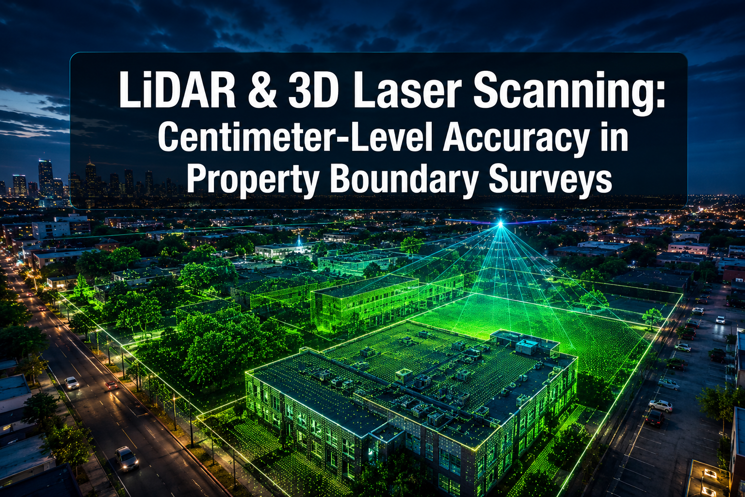
Boundary disputes cost UK property owners an estimated tens of millions of pounds each year in legal fees, delayed transactions, and remediation works — yet many of those disputes stem from measurement errors that modern technology can now eliminate entirely. The discipline of LiDAR and 3D laser scanning: achieving centimeter-level accuracy in property boundary surveys has moved from specialist research laboratories into everyday surveying practice, and in 2026 it represents the most significant leap in spatial measurement since the introduction of GPS.
This article examines how LiDAR and terrestrial laser scanning work, how they compare with traditional survey methods, how GNSS RTK integration is sharpening results further, and what property owners, developers, and legal professionals need to know before commissioning a boundary survey.
Key Takeaways
- Modern terrestrial laser scanners capture more than 2 million data points per second with positional accuracy of plus or minus 1-2 mm at ranges up to 350 metres.
- Integrating LiDAR with GNSS RTK positioning anchors scan data to national coordinate systems, achieving horizontal accuracies of plus or minus 10-20 mm.
- UAV-mounted LiDAR systems reduce survey time by 60-80% on large or complex sites compared with traditional methods.
- Environmental factors such as temperature fluctuations and surface reflectivity can introduce errors of up to plus or minus 8-12 mm if not properly managed.
- LiDAR data is increasingly accepted as evidence in boundary dispute litigation and planning applications across England and Wales.
How LiDAR and 3D Laser Scanning Work in Property Boundary Surveys
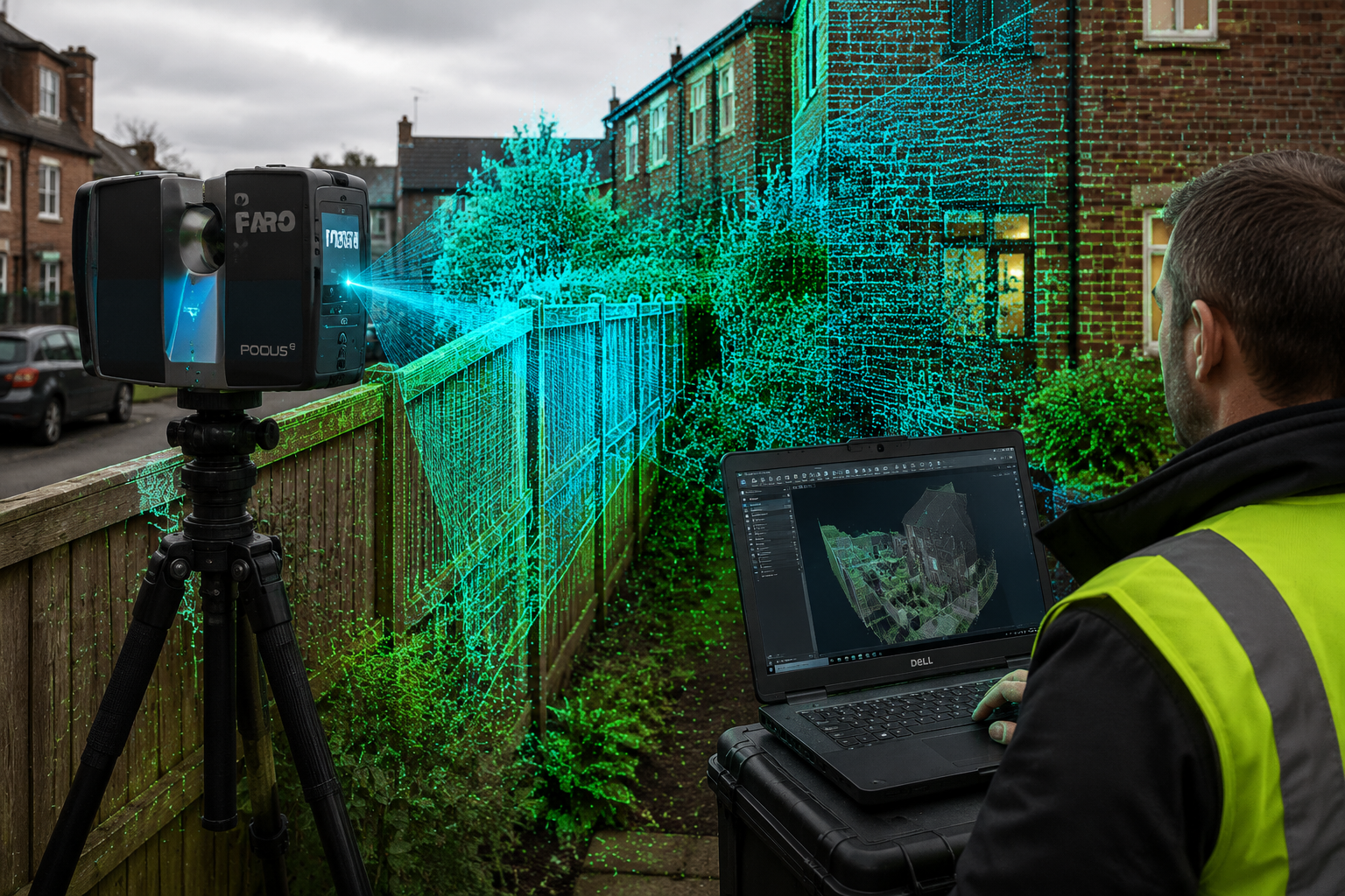
LiDAR — Light Detection and Ranging — works by emitting rapid pulses of laser light and measuring the time each pulse takes to return after bouncing off a surface. That travel time is converted into a precise distance measurement. Repeat this process millions of times per second across a rotating mirror system, and the result is a dense, three-dimensional cloud of georeferenced data points known as a point cloud.
In a property boundary context, that point cloud becomes a faithful digital replica of the physical world: fence lines, wall faces, kerb edges, tree trunks, and building corners are all captured with sub-centimetre fidelity. Modern terrestrial laser scanning (TLS) devices achieve positional accuracies of plus or minus 1-2 mm at distances up to 350 metres, capturing over 2 million data points per second [1].
Terrestrial Laser Scanning vs. Traditional Survey Methods
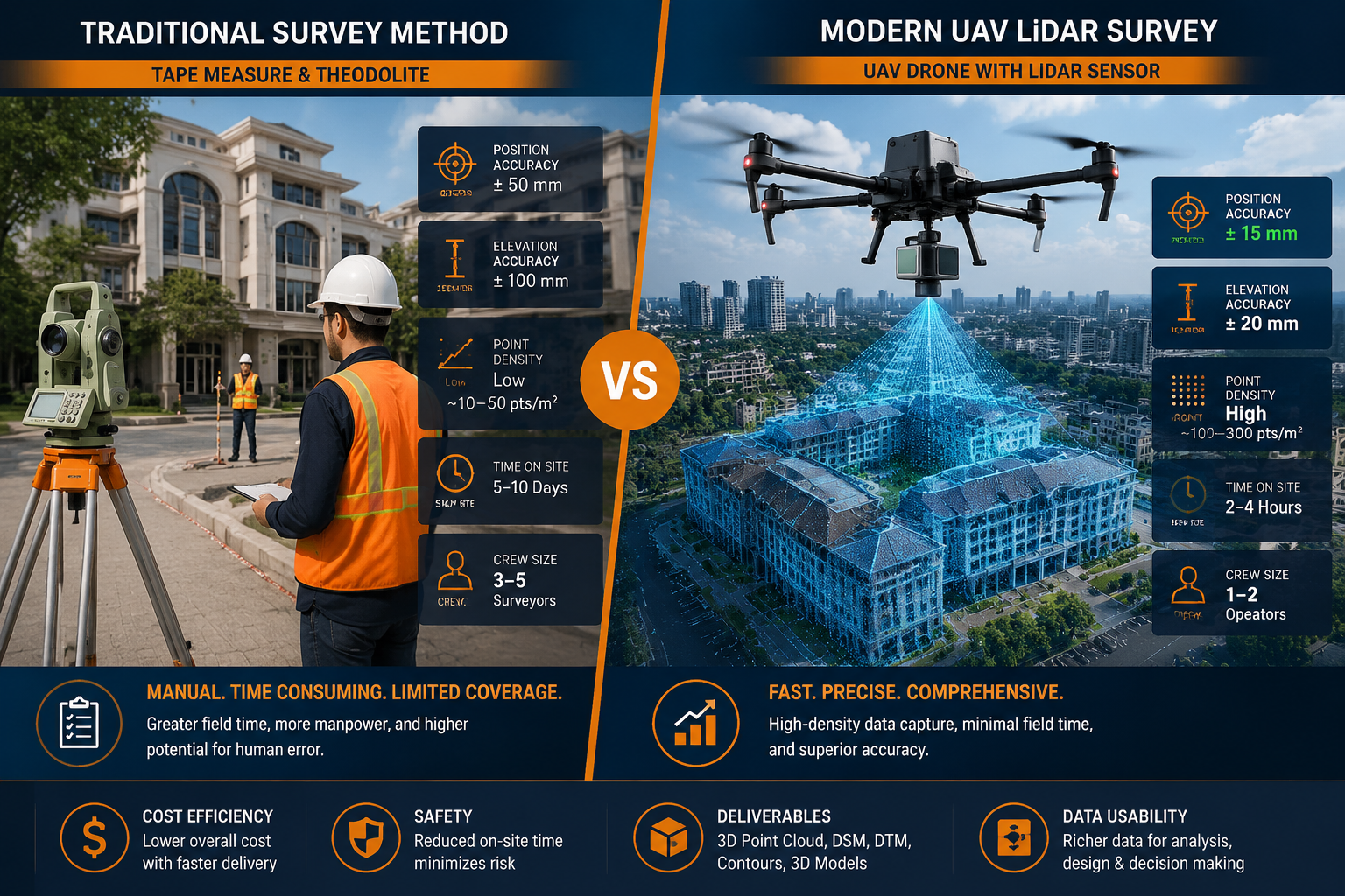
For decades, boundary surveys relied on total stations, theodolites, and steel tape measures. These tools are accurate in skilled hands, but they are inherently point-by-point processes. A surveyor selects which features to measure; anything not deliberately targeted is not recorded. This selectivity introduces gaps that become problematic when a dispute later hinges on a feature nobody thought to measure at the time.
| Feature | Traditional Survey | TLS / LiDAR Survey |
|---|---|---|
| Data density | Selected points only | Millions of points per scan |
| Typical accuracy | plus or minus 5-20 mm | plus or minus 1-5 mm |
| Time on site (typical plot) | 4-8 hours | 1-3 hours |
| Revisit risk | High | Low (real-time QC possible) |
| Legal defensibility | Established | Growing acceptance |
| Cost per survey | Lower upfront | Higher upfront, lower lifecycle |
The contrast is stark. A traditional survey of a disputed urban terrace might capture 40-60 measured points. A single TLS setup on the same site captures several hundred million. That density means no ambiguity about where a wall face actually sits.
Advancements in real-time point cloud processing now allow surveyors to perform on-site quality checks the moment scanning is complete, reducing the need for costly return visits and significantly improving overall efficiency [1]. This is particularly valuable in urban Manchester, where site access windows are often tightly controlled by residents or commercial tenants.
Mobile LiDAR: Flexibility Without Sacrificing Precision
Mobile laser scanning (MLS) systems mount LiDAR sensors on vehicles, backpacks, or handheld rigs, allowing surveyors to capture data while moving through a site. With proper calibration and the use of ground control points, mobile LiDAR systems can match the accuracy of static terrestrial scanners, achieving relative accuracies within a few millimetres [2]. Recent studies have highlighted the growing use of mobile laser scanning in urban planning and environmental monitoring applications, driven by its combination of efficiency and accuracy [5].
For long linear boundaries — road frontages, canal-side properties, or railway-adjacent land — mobile scanning dramatically reduces field time while maintaining the data density needed for reliable boundary delineation.
GNSS RTK Integration and the 2026 Accuracy Standard
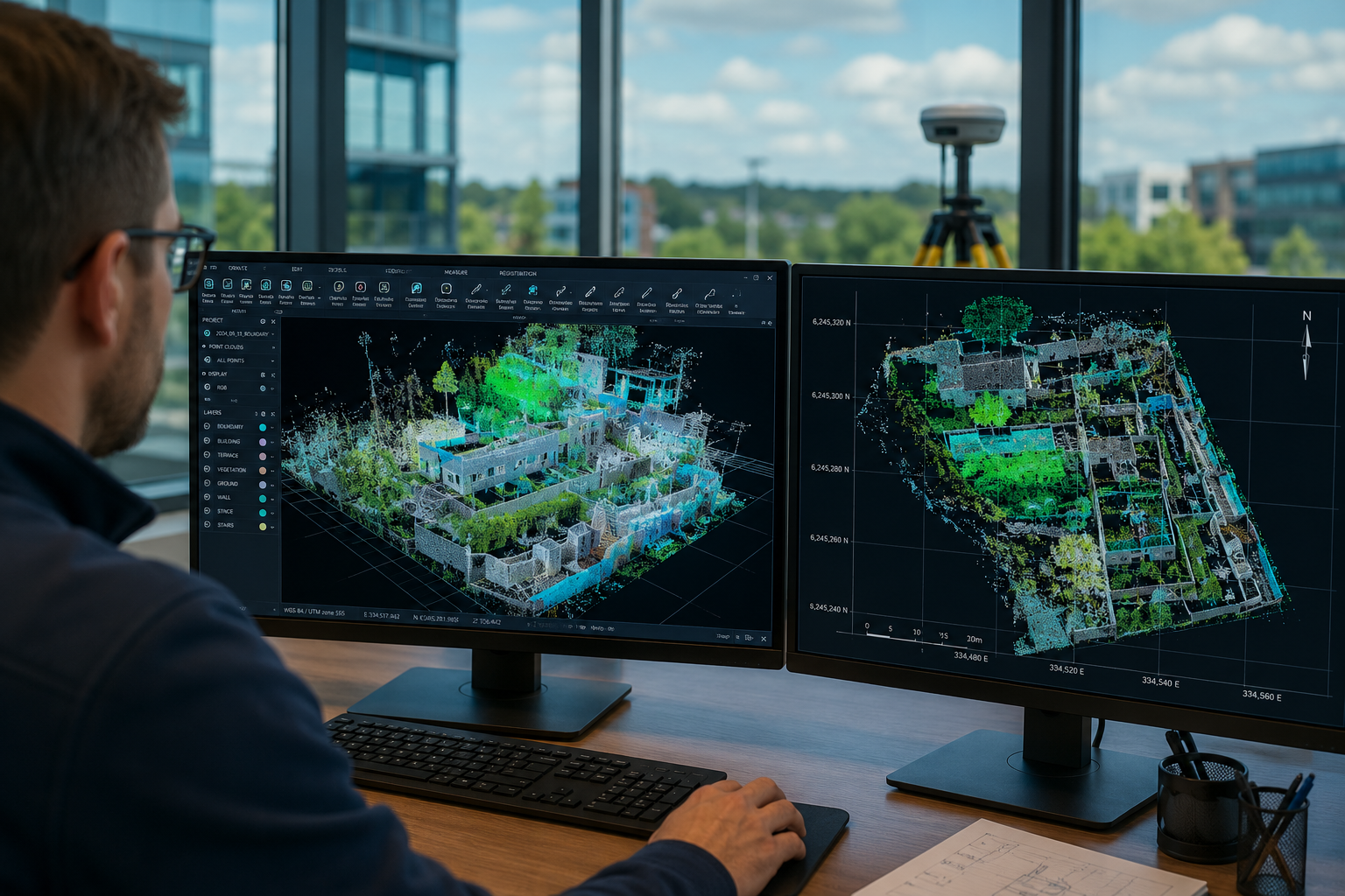
A point cloud is only as useful as its relationship to the real world. Raw scan data exists in a local coordinate frame tied to the scanner's position. To be legally and practically meaningful in a property boundary context, that data must be anchored to a national coordinate system such as the Ordnance Survey National Grid.
This is where GNSS RTK (Global Navigation Satellite System Real-Time Kinematic) integration becomes essential. By combining TLS scan data with RTK positioning, surveyors anchor every point in the cloud to national coordinates, achieving horizontal accuracies of plus or minus 10-20 mm [1]. In 2026, this workflow has become the accepted standard for high-stakes boundary work, replacing the older practice of relying solely on Ordnance Survey base mapping — which carries its own inherent positional tolerances of 1-3 metres at 1:1250 scale.
Why GNSS RTK Matters for Disputed Boundaries
When a boundary dispute reaches a solicitor's desk or a court, the question is not just "where is the boundary?" but "how do you know?" A survey supported by GNSS RTK-corrected LiDAR data can demonstrate:
- The absolute position of each measured feature in national coordinates
- The statistical confidence interval around each measurement
- A complete, auditable record of how the data was collected and processed
This level of documentation is far harder to challenge than a hand-drawn sketch or a total station traverse with a handful of measured points. Chartered surveyors who specialise in boundary work are increasingly expected to provide this standard of evidence, particularly when instructions involve potential litigation.
UAV LiDAR: Speed at Scale
For large or topographically complex sites — multi-plot developments, agricultural land, or industrial estates — UAV-mounted LiDAR systems offer a compelling alternative to ground-based scanning. These systems have been shown to reduce survey time by 60-80% on large or complex sites, with vertical accuracies of plus or minus 3-5 cm and horizontal accuracies of 2-5 cm [1].
While UAV LiDAR is marginally less precise than TLS for fine boundary detail at the millimetre level, it excels at capturing the broader spatial context: terrain shape, vegetation encroachment, drainage patterns, and the relationship between multiple parcels. When combined with ground-based TLS for critical boundary features, the two methods produce a dataset that is both comprehensive and precise.
Drone survey services have evolved rapidly alongside LiDAR technology, and the two are now routinely deployed together on complex urban and peri-urban sites.
Combining LiDAR with Photogrammetry
Integrating LiDAR with photogrammetric techniques — using overlapping photographs to generate 3D models — produces richer, more verifiable datasets than either method alone [1]. LiDAR excels in low-light conditions, under tree canopy, and where surface texture is poor. Photogrammetry adds colour and texture information that aids feature identification. Together, they create a dataset where every point has both a precise 3D coordinate and a visual context, making boundary features unambiguous even to non-specialists such as judges or planning officers.
Innovative techniques such as radiometric fingerprinting using mobile laser scanning and semantic 3D models are also beginning to allow detailed analysis of object surfaces, broadening the application spectrum further into urban digital twins and heritage recording [6].
Practical Applications, Limitations, and Choosing the Right Approach
Understanding where LiDAR excels — and where it requires careful management — is essential for anyone commissioning a boundary survey.
Where LiDAR Delivers the Greatest Value
Disputed urban boundaries are the clearest use case. When two neighbours disagree about where a party wall sits, or a developer needs to prove that a new building sits within the title plan, LiDAR provides an objective, repeatable, and legally defensible record. The data can be re-interrogated years later without any loss of information, which is invaluable if a dispute resurfaces.
Pre-purchase due diligence is another high-value application. A buyer considering a property where the title plan appears inconsistent with the physical boundaries on the ground can commission a LiDAR scan as part of a broader building survey to resolve the discrepancy before exchange. This is far less costly than discovering an encroachment after completion.
Party wall matters frequently benefit from LiDAR data. A schedule of condition prepared using point cloud data captures the precise position and condition of a shared wall before any adjacent works begin, providing an unambiguous baseline if damage claims arise later.
Monitoring surveys on sites subject to ground movement — whether from subsidence, construction vibration, or slope instability — can use repeated LiDAR scans to detect millimetre-level changes over time. This application is explored in detail through monitoring survey services that track structural behaviour across multiple scan epochs.
LiDAR scanning also provides value-added services in home inspections, including the creation of highly accurate floor plans and measurements that go well beyond what traditional tape-and-sketch methods can achieve [4].
Environmental Factors That Can Affect Accuracy
LiDAR is not immune to environmental interference. Two factors deserve particular attention:
- Temperature fluctuations: Thermal expansion of scanner components and atmospheric refraction can introduce errors of plus or minus 8-12 mm if not compensated for during processing [3].
- Surface reflectivity: Highly reflective surfaces (glass, polished metal, wet tarmac) and highly absorptive surfaces (dark timber, matte black cladding) can cause intensity saturation or signal dropout, introducing errors of plus or minus 5-8 mm [3].
Experienced surveyors mitigate these effects through careful scan planning, the use of calibrated targets, and post-processing corrections. When commissioning a LiDAR survey, it is worth asking the provider to confirm their quality assurance workflow and the expected accuracy budget for the specific site conditions.
Structural and Subsidence Surveys: A Natural Complement
Boundary surveys rarely exist in isolation. A property with a disputed boundary may also have structural concerns, particularly in older urban terraces where differential settlement has caused walls to lean or shift over time. LiDAR data captures both the boundary position and the structural geometry simultaneously, making it a natural complement to structural surveys and subsidence investigations.
The ability to overlay a point cloud on a structural model means that a surveyor can demonstrate not just where a wall is, but whether it is vertical, whether it has rotated, and by how much — all from a single field campaign.
Cost Considerations
LiDAR surveys carry a higher upfront cost than traditional methods, but the lifecycle economics often favour them. Reduced field time, elimination of return visits, lower risk of dispute escalation, and the creation of a permanent digital record all contribute to a lower total cost of ownership. For anyone weighing options, reviewing survey pricing alongside the scope of work is the most reliable way to assess value.
Selecting a Qualified Surveyor
The quality of a LiDAR survey depends as much on the surveyor's expertise as on the equipment used. In England and Wales, boundary surveys with legal implications should be carried out by a RICS-chartered surveyor with demonstrable experience in geospatial measurement. RICS membership provides a framework of professional standards, indemnity insurance, and a complaints procedure — all of which matter when survey data may be used as evidence.
When a boundary dispute has already reached the point of legal proceedings, a surveyor may be required to act as an expert witness, presenting LiDAR evidence to a court or tribunal. This requires not only technical competence but also the ability to communicate complex spatial data clearly to a non-specialist audience.
Conclusion
LiDAR and 3D laser scanning: achieving centimeter-level accuracy in property boundary surveys is no longer a future aspiration — it is the operational reality for surveyors working on complex, high-stakes, or disputed sites in 2026. The combination of terrestrial laser scanning, GNSS RTK integration, UAV-mounted sensors, and photogrammetric fusion has created a measurement toolkit that is faster, denser, and more legally defensible than anything available to previous generations of surveyors.
Actionable next steps for property owners and professionals:
- If a boundary is in dispute or appears inconsistent with title documentation, commission a LiDAR survey before taking any legal or construction action. The cost of accurate data is a fraction of the cost of litigation.
- Ensure the surveyor is RICS-chartered and can demonstrate experience with point cloud data processing and GNSS RTK workflows.
- Ask for a written accuracy statement specifying the expected positional tolerance for the site conditions, including any environmental factors that may affect results.
- Consider combining a boundary survey with a structural or condition survey to maximise the value of a single site mobilisation.
- Retain the raw point cloud data as a permanent asset — it can be re-interrogated for future planning applications, sale negotiations, or dispute resolution without any additional field work.
The technology exists. The professional standards are in place. The remaining variable is whether property owners and their advisers choose to use the most accurate tools available.
References
[1] Lidar And 3d Laser Scanning In 2026 Property Surveys Achieving Unmatched Accuracy And Efficiency – https://www.canterburysurveyors.com/blog/lidar-and-3d-laser-scanning-in-2026-property-surveys-achieving-unmatched-accuracy-and-efficiency/?utm_source=openai
[2] Highest Accuracy – https://www.lidarusa.com/highest-accuracy.html?utm_source=openai
[3] Lidar Surveying Accuracy Comparison – https://surveyingpedia.com/article/lidar-surveying-accuracy-comparison?utm_source=openai
[4] Lidar Scanning And Home Inspections Is It Worth It – https://fullviewdigital.com/lidar-scanning-and-home-inspections-is-it-worth-it/?utm_source=openai
[5] 19475705.2021 – https://www.tandfonline.com/doi/full/10.1080/19475705.2021.1964617?utm_source=openai
[6] arxiv – https://arxiv.org/abs/2603.11252?utm_source=openai