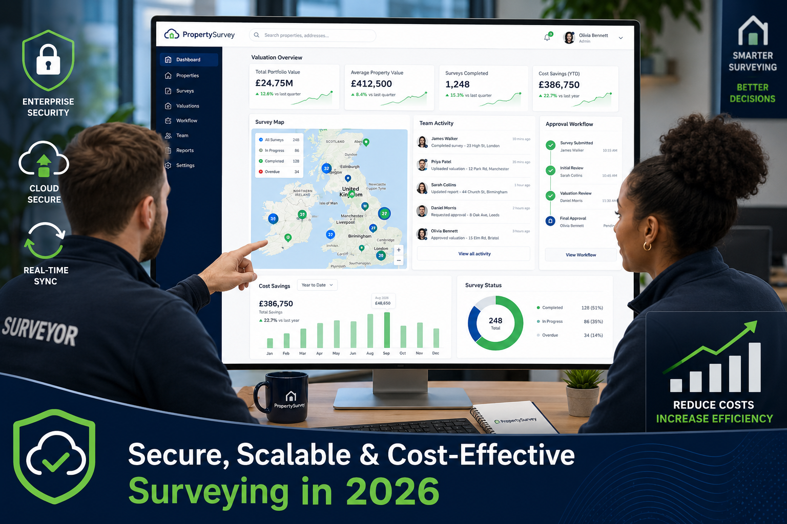
Firms that have adopted cloud-based surveying platforms report saving between 6 and 10 hours per person, per week — simply by eliminating redundant file transfers and fragmented communication. That figure alone signals a fundamental shift in how property professionals work in 2026. Cloud Computing's Role in Collaborative Property Surveying Workflows is no longer a future trend; it is the operational backbone of modern surveying practice.
From RICS home surveys to large-scale commercial property valuations, surveyors across the UK are discovering that cloud technology reduces costs, accelerates delivery, and makes real-time collaboration genuinely possible — whether team members are in Manchester, London, or on-site at a remote property.
Key Takeaways 📌
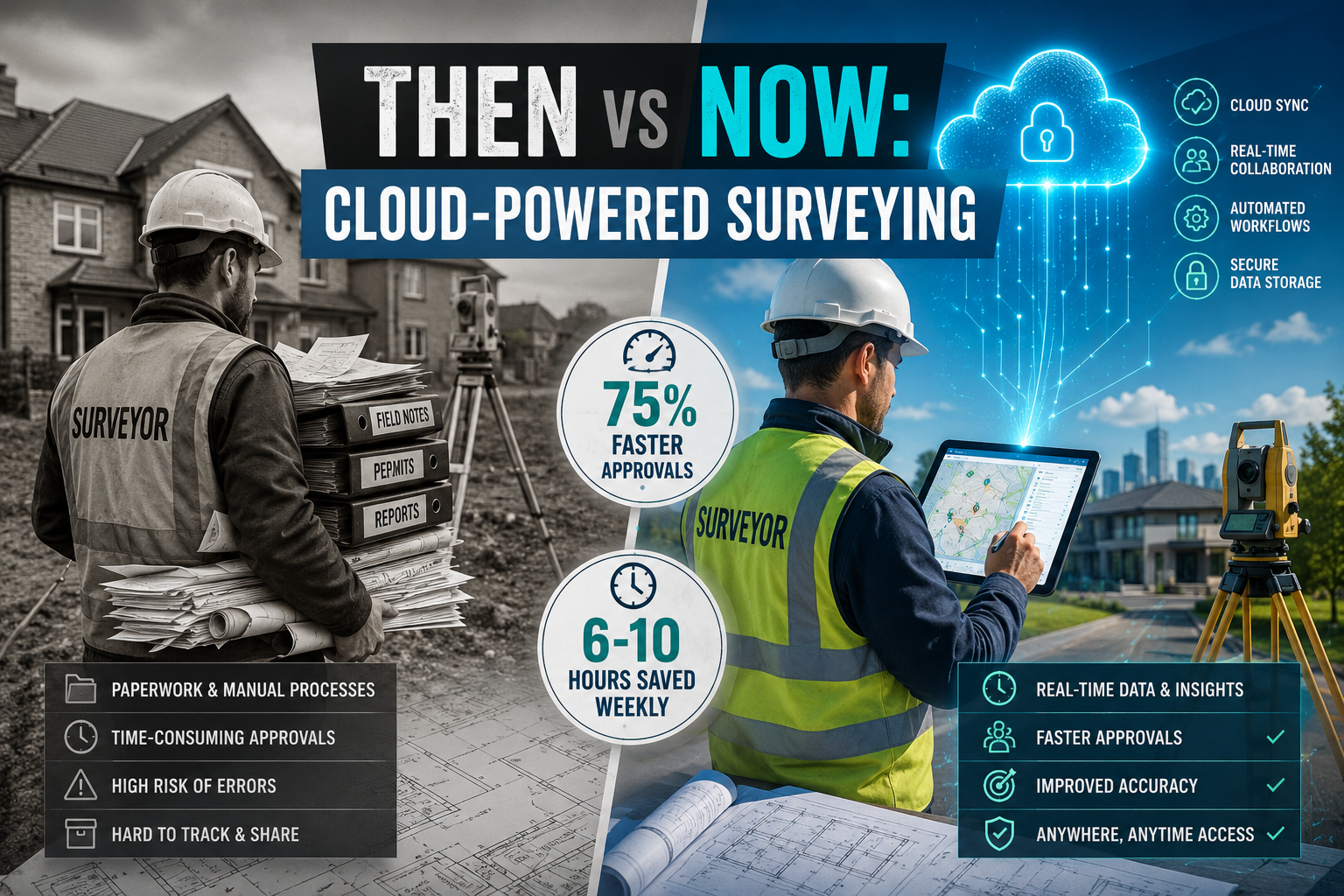
- Cloud platforms cut approval cycle times by up to 75%, replacing slow paper-based and desktop-bound workflows.
- Offline-first tools allow surveyors to capture data without internet access, syncing automatically when reconnected.
- AI-assisted processing turns weeks of LiDAR and photogrammetry work into hours, with survey-grade accuracy.
- Centralised cloud workspaces eliminate version confusion, reduce errors, and keep all stakeholders aligned in real time.
- Transitioning from traditional methods is achievable in phases — starting with data storage and moving toward full workflow automation.
Why Traditional Surveying Workflows Are Holding Teams Back
For decades, property surveying relied on a familiar but inefficient chain: field notes on paper, measurements transferred manually to desktop software, reports emailed back and forth, and approvals waiting in inboxes. Each handoff introduced delay and risk.
The problems compound quickly on complex projects:
- 🗂️ Version control failures — multiple team members editing different copies of the same document
- 📬 Slow approvals — paper-based sign-off processes that can take days or weeks
- 💾 Hardware dependency — powerful processing software locked to a single office machine
- 🚗 Travel overhead — unnecessary site revisits caused by incomplete or lost field data
- 📉 Scalability limits — growing workloads that outpace desktop infrastructure
"The biggest cost in traditional surveying isn't equipment — it's time lost to broken information chains."
These inefficiencies are especially visible in RICS Level 3 building surveys, where detailed defect documentation, structural assessments, and photographic evidence must be compiled into a coherent, professional report. Any gap in the data chain delays the final deliverable — and delays cost money.
Understanding Cloud Computing's Role in Collaborative Property Surveying Workflows

Cloud Computing's Role in Collaborative Property Surveying Workflows operates across three core functions: data storage and access, processing and analysis, and team collaboration and delivery. Understanding each layer helps surveying firms identify where cloud adoption will have the greatest impact.
1. 🗄️ Cloud Storage: Centralised, Accessible, Secure
The most immediate benefit of cloud adoption is replacing local hard drives and email attachments with a single, accessible data repository. Platforms like AllGiS allow teams to upload, process, quality-check, and deliver geospatial data from one unified workspace — eliminating the need for multiple file transfers and saving those critical 6–10 hours per week per person [6].
Key storage advantages include:
| Feature | Traditional Method | Cloud Method |
|---|---|---|
| Data access | Single device | Any device, anywhere |
| Version control | Manual, error-prone | Automatic, timestamped |
| Backup | Manual or scheduled | Continuous, automated |
| Collaboration | Email attachments | Live shared workspace |
| Security | Local IT dependent | Enterprise-grade encryption |
For firms handling sensitive RICS valuations or capital gains tax assessments, data security is non-negotiable. Reputable cloud platforms offer role-based access controls, audit trails, and compliance-ready infrastructure.
2. ⚙️ Cloud Processing: Turning Raw Data into Deliverables Faster
Processing large datasets — particularly LiDAR point clouds and photogrammetry outputs — has historically required expensive, high-specification workstations. Cloud processing removes that hardware barrier entirely.
ROCK Cloud processes over 1 million acres of LiDAR data monthly across more than 500 firms, delivering survey-grade CAD outputs with AI-powered accuracy and a 24-hour turnaround [5]. That kind of throughput would be impossible on a standard office desktop.
Similarly, Pointerra's Digital Surveyor Bundle replaces slow, desktop-bound workflows with browser-based processing, compressing weeks of analytical work into hours [7]. Agisoft Metashape's cloud integration allows users to perform precise measurements and annotations without any local hardware constraints [8].
ATIS.cloud takes this further with a structured four-step workflow — 3D site capture, scan registration, cloud-based sharing, and export to CAD/BIM — that reduces delivery times by approximately two hours per project [2]. Across a busy firm handling dozens of projects monthly, that adds up to significant competitive advantage.
3. 🤝 Real-Time Collaboration: Connecting Field and Office Teams
Perhaps the most transformative aspect of cloud technology is its ability to close the gap between field surveyors and office-based teams.
Hexagon's GeoCloud enables immediate data upload from the field, centralised management and validation, and secure sharing with stakeholders — removing the bottlenecks that traditionally slowed geodata workflows [9]. Field surveyors no longer need to return to the office to hand off data; it flows automatically.
Woolpert's CAMACloud® specifically addresses property valuation workflows, connecting field and office teams through real-time data synchronisation, integrated sketching, and automated analytics. The result is reduced operational costs and improved valuation accuracy [10] — directly relevant to professionals conducting RICS building surveys or monitoring surveys.
Cost-Effective Cloud Solutions for 2026 Surveying Projects
One of the most common concerns about cloud adoption is cost. The good news: the economics strongly favour cloud over traditional infrastructure in 2026.
Breaking Down the Cost Comparison 💰
Traditional infrastructure costs typically include:
- High-spec workstations (£2,000–£5,000+ per unit)
- Software licences (often per-seat, annually renewed)
- IT maintenance and support
- Physical server storage and backup systems
- Travel costs from data-related site revisits
Cloud platform costs typically include:
- Subscription-based pricing (scalable by usage)
- No hardware investment for processing
- Automatic updates included
- Pay-as-you-grow storage
The shift from capital expenditure to operational expenditure makes cloud solutions accessible to small and mid-sized surveying firms that cannot justify large upfront hardware investments.
Standout Platforms Worth Considering
🔵 Survii (Offline-First Surveying): Designed specifically for property professionals, Survii allows surveyors to work without internet connectivity — capturing photos, measurements, and detailed documentation — then automatically syncing all data when a connection is restored [1]. This is particularly valuable for rural or basement surveys where connectivity is unreliable.
🟢 Looq AI (Handheld Photogrammetry): Looq AI combines a handheld camera with AI-powered cloud processing and a collaborative web viewer, producing survey-grade 3D point clouds without LiDAR equipment or drones [4]. The cost saving on hardware alone is substantial.
🟠 DigitalPlat (Automated Approvals): For firms dealing with plat surveys and multi-party approvals, DigitalPlat's AI-assisted signature detection and parallel approval workflows have delivered up to a 75% reduction in approval cycle time [3]. Fewer delays mean faster project completion and improved cash flow.
"Cloud platforms don't just save time — they fundamentally change what a small surveying team can achieve."
How Cloud Computing's Role in Collaborative Property Surveying Workflows Supports Specialist Surveys
Cloud Computing's Role in Collaborative Property Surveying Workflows extends beyond standard residential surveys. Specialist survey types benefit significantly from cloud-enabled collaboration.
🏢 Commercial and Dilapidations Surveys
Dilapidation surveys involve detailed photographic records, condition schedules, and often multiple rounds of stakeholder review. Cloud platforms allow all parties — surveyors, solicitors, landlords, and tenants — to access the same documentation simultaneously, reducing disputes and accelerating settlement.
🧱 Party Wall and Boundary Work
Party wall matters frequently involve two surveyors representing different parties. Cloud-shared condition schedules and photographic evidence remove ambiguity and create a clear, timestamped audit trail — essential if a dispute escalates.
🔍 Damp and Structural Surveys
Damp surveys and structural assessments require precise documentation of moisture readings, crack patterns, and photographic evidence. Cloud platforms with 360° documentation capabilities — like 3D Measure — enable remote measurements and professional report generation, streamlining the entire inspection workflow.
Practical Tips for Transitioning from Traditional to Cloud-Based Surveying
Switching to cloud-based workflows does not have to happen overnight. A phased approach reduces disruption and builds team confidence.
🗺️ A Phased Transition Roadmap
Phase 1 — Cloud Storage First (Weeks 1–4)
- Move project files from local drives to a cloud storage platform (e.g., Google Drive, SharePoint, or a specialist surveying platform)
- Establish folder naming conventions and access permissions
- Train all team members on basic upload and retrieval
Phase 2 — Field Data Capture (Weeks 5–8)
- Introduce a mobile-first or offline-capable field data tool (e.g., Survii)
- Standardise photo capture protocols and measurement recording
- Test automatic sync workflows before relying on them for client projects
Phase 3 — Cloud Processing Integration (Weeks 9–16)
- Pilot cloud-based processing for one project type (e.g., LiDAR or photogrammetry)
- Compare output quality and turnaround time against previous desktop methods
- Evaluate cost per project against traditional processing costs
Phase 4 — Full Collaboration Workflow (Month 4+)
- Implement real-time collaboration tools for report review and approval
- Connect field, office, and client-facing workflows through a unified platform
- Review time savings and cost reductions; adjust subscriptions accordingly
✅ Key Transition Tips
- Start with one project type rather than overhauling everything at once
- Involve field surveyors early — their buy-in is critical to adoption success
- Choose platforms with offline capability to avoid connectivity-related disruptions
- Audit data security — ensure chosen platforms meet GDPR and professional body requirements
- Track time savings from the first week to build an internal business case
Challenges to Be Aware Of
Cloud adoption is not without its complications. Surveying firms should plan for:
| Challenge | Mitigation Strategy |
|---|---|
| Internet reliability on-site | Choose offline-first platforms like Survii [1] |
| Data security concerns | Verify ISO 27001 certification and GDPR compliance |
| Staff resistance to change | Phased rollout with hands-on training |
| Integration with legacy software | Check API compatibility before committing |
| Subscription cost creep | Audit usage quarterly and right-size plans |
Conclusion: Actionable Next Steps for Surveying Firms in 2026
The evidence is clear: cloud technology is reshaping every stage of the property surveying process — from initial site capture to final report delivery. Firms that embrace these tools gain a measurable edge in speed, accuracy, and client satisfaction.
Here are five actionable next steps to take right now:
- Audit your current workflow — identify the three biggest time sinks in your surveying process today
- Trial one cloud storage platform for a single project type this month — measure the time difference
- Evaluate offline-capable field tools like Survii to eliminate connectivity-related data gaps [1]
- Explore AI-assisted processing platforms (ROCK Cloud, Pointerra, Looq AI) for your most data-heavy survey types [5][7][4]
- Review your collaboration tools — if approvals still happen by email, a platform like DigitalPlat could cut that cycle by 75% [3]
Whether your firm handles RICS-specific defect surveys, residential valuations, or complex commercial assessments, the cloud offers a scalable, cost-effective path to better outcomes. The transition requires planning, but the return — in time saved, errors avoided, and clients impressed — makes it one of the most valuable investments a surveying firm can make in 2026.
References
[1] survii – https://www.survii.io/?utm_source=openai
[2] The Datis Cloud Workflow – https://www.atis.cloud/articles/the-datis-cloud-workflow?utm_source=openai
[3] digitalplat – https://digitalplat.com/?utm_source=openai
[4] looq.ai – https://looq.ai/?utm_source=openai
[5] Rock Cloud – https://www.rockrobotic.com/software/rock-cloud/?utm_source=openai
[6] allgis – https://allgis.io/?utm_source=openai
[7] Digital Surveyor Bundle – https://www.pointerra.com/product/digital-surveyor-bundle/?utm_source=openai
[8] Cloud – https://www.agisoft.com/features/cloud/?utm_source=openai
[9] Workflow – https://geocloud.hexagon.com/workflow/?utm_source=openai
[10] Camacloud – https://woolpert.com/solutions/data-and-technology/camacloud/?utm_source=openai