A boundary dispute over just 12 centimeters of land in a dense New Jersey neighborhood recently resulted in a six-figure legal settlement — a stark reminder that in urban property surveying, fractions of a measurement matter enormously. The good news is that GNSS RTK Enhancements: Achieving Centimeter-Level Accuracy for Urban Property Boundary Surveys in 2026 have transformed what was once a near-impossible technical challenge into a reliable, repeatable workflow. Where satellite signals once bounced off glass towers and produced wildly inconsistent results, today's integrated receiver systems, correction networks, and sensor fusion technologies deliver positioning accuracy measured in single-digit centimeters, even in the most congested city cores.
Key Takeaways
- Modern dual-frequency, multi-constellation GNSS receivers improve positioning accuracy by 30-50% in urban canyon environments compared to legacy single-frequency systems.
- Sensor fusion — combining RTK with lidar, inertial navigation, and SLAM — maintains centimeter-level accuracy where satellite visibility alone is insufficient.
- Low-cost hardware such as the u-blox ZED-F9P chip has democratized high-precision urban surveying without sacrificing accuracy.
- RTK correction services and continuously operating reference station (CORS) networks are critical infrastructure for reliable urban boundary work.
- Drone-based RTK/PPK photogrammetry now achieves horizontal errors of approximately 2-3 cm in urban environments, expanding the surveyor's toolkit significantly.
Why Urban Environments Are the Hardest Test for GNSS RTK
Real-Time Kinematic (RTK) GNSS positioning works by comparing carrier-phase measurements between a rover receiver and a fixed base station or network, resolving integer ambiguities to deliver centimeter-level results. In open farmland or rural corridors, this process is relatively straightforward. In cities like Jersey City, Miami, or central Manchester, the environment fights back.
The Urban Canyon Problem
Multipath interference is the defining challenge of urban GNSS surveying. When satellite signals reflect off glass facades, steel structures, and concrete walls before reaching the receiver antenna, the receiver interprets the delayed signal as a legitimate measurement. The result is position wander, solution instability, and sudden coordinate jumps that can exceed several meters [6].
Compounding this, tall buildings physically block large portions of the sky, reducing the number of visible satellites. Fewer satellites mean weaker geometry — quantified as a high Dilution of Precision (DOP) value — which directly degrades accuracy. In deep urban canyons, a receiver may track only four to six satellites at any moment, compared to twelve or more in open sky.
Key urban GNSS challenges include:
- Signal multipath from reflective building surfaces
- Signal blockage from tall structures reducing visible satellite count
- Non-line-of-sight (NLOS) reception where reflected signals masquerade as direct ones
- Atmospheric delays amplified by the inability to average across a healthy satellite geometry
- Rapid solution status changes between fixed, float, and single-point modes
Continuous monitoring of solution quality flags — particularly the ratio test value and the age of differential correction — is essential when working in these conditions [6]. Surveyors conducting boundary surveys in dense urban areas must understand these failure modes before relying on any RTK-derived coordinate.
The Stakes for Property Boundary Accuracy
Urban land is among the most valuable on Earth. A cadastral error of even 10-15 centimeters in a tightly packed residential block can misplace a fence line, invalidate a planning application, or trigger a boundary dispute. The legal and financial consequences demand that surveyors working in cities apply the most rigorous positional accuracy standards available. This is precisely where the latest GNSS RTK enhancements prove their worth.
Core GNSS RTK Enhancements Driving Centimeter-Level Accuracy in 2026
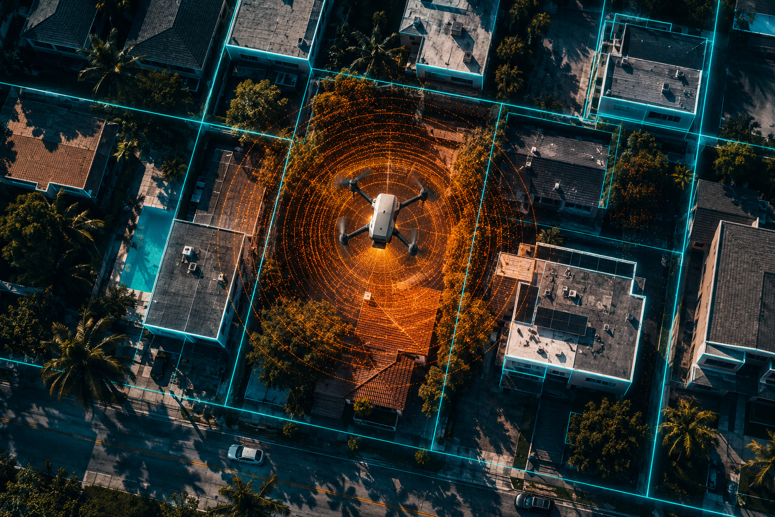
The convergence of hardware innovation, software algorithms, and networked correction infrastructure has produced a step-change in what RTK can deliver in urban environments. Understanding these enhancements helps both surveyors and property professionals make informed decisions about the tools and methodologies they commission.
Dual-Frequency, Multi-Constellation Receivers
The single most impactful hardware advancement has been the widespread adoption of dual-frequency, multi-constellation GNSS receivers. By simultaneously tracking signals from GPS, GLONASS, Galileo, BeiDou, and QZSS across both L1 and L2 (or L5) frequencies, modern receivers access more than 40 satellites at any given moment [1]. This expanded satellite pool dramatically improves geometric diversity, reducing DOP values even in partially obstructed urban skies.
Dual-frequency operation also enables the receiver to model and remove ionospheric delay errors — a major source of positioning error that single-frequency receivers cannot fully correct. The practical result is a 30-50% improvement in positioning accuracy in urban canyon environments compared to legacy single-frequency equipment [1].
"The ability to track 40-plus satellites across multiple constellations and two frequencies has fundamentally changed the reliability of RTK in cities. It is no longer a question of whether centimeter accuracy is achievable — it is a question of which workflow delivers it most efficiently."
Advanced Multipath Mitigation Algorithms
Hardware alone is insufficient. Leading receiver manufacturers now embed proprietary signal processing algorithms that identify and suppress multipath-contaminated measurements before they corrupt the position solution [1]. These algorithms analyze signal-to-noise ratio patterns, elevation angles, and carrier-phase consistency to flag suspect observations. Contaminated measurements are either down-weighted or excluded from the ambiguity resolution process entirely.
The combination of improved antenna design — particularly choke-ring and ground-plane antennas that reject low-elevation signals — with algorithmic filtering delivers the 30-50% accuracy improvement observed in field studies [1].
Low-Cost High-Precision Hardware: The Democratization Effect
Until recently, centimeter-level GNSS hardware cost tens of thousands of pounds or dollars. That barrier has collapsed. The u-blox ZED-F9P dual-frequency GNSS chip, paired with the ANN-MB-00 patch antenna, has demonstrated horizontal accuracy of 20 mm and vertical accuracy of 15 mm in urban test environments [5]. This chip is now embedded in a growing range of mid-market survey rovers, making high-precision urban boundary work accessible to a broader range of surveying firms.
This democratization matters for property professionals who commission chartered surveyor services — competitive pricing for high-accuracy surveys is increasingly feasible without compromising on positional quality.
RTK Correction Services and CORS Networks
RTK requires a correction data stream from a known reference point. In urban areas, Continuously Operating Reference Station (CORS) networks and commercial correction services have become essential infrastructure. Trimble's CenterPoint RTX service, for example, delivers 2 cm accuracy for precise survey work, complementing traditional base-station RTK setups and enhancing reliability where establishing a local base is impractical [9].
Network RTK (NRTK) services, which synthesize corrections from multiple reference stations, further improve performance in urban areas by modelling spatially variable errors more accurately than a single base station can.
Sensor Fusion: RTK Plus Lidar, IMU, and SLAM
The most significant frontier in GNSS RTK Enhancements: Achieving Centimeter-Level Accuracy for Urban Property Boundary Surveys in 2026 is the integration of RTK with complementary sensor technologies.
Lidar-aided ambiguity resolution uses lidar point-cloud data to constrain the GNSS ambiguity search space. Research has demonstrated that integrating lidar measurements with GNSS observations enables successful instantaneous ambiguity resolution, achieving centimeter-level vehicle positioning even when only a limited number of satellites are visible [4]. For urban boundary surveys, this means reliable fixes in conditions that would cause a standalone RTK system to revert to float or single-point mode.
Tightly coupled RTK and Inertial Navigation Systems (INS) address the gaps that occur when satellite signals are temporarily blocked — for example, when a surveyor passes beneath a bridge or through a building entrance. An optimization-based framework for tightly coupled RTK-INS has demonstrated that 85.84% of horizontal errors remain below 1.5 metres and 92.07% of vertical errors remain below 3 metres in deep urban datasets [3]. While these figures represent degraded-mode performance rather than centimeter accuracy, they confirm that the system maintains a usable solution rather than failing entirely.
RTK integrated with Simultaneous Localization and Mapping (SLAM) systems represents the cutting edge. Studies have shown that RTK-SLAM combinations achieve centimeter-level accuracy in open-sky conditions and maintain decimeter-level accuracy indoors, where standalone RTK performance collapses entirely [2]. For urban boundary surveys that require measurements adjacent to building interiors or in covered walkways, this capability is transformative.
| Technology | Typical Urban Accuracy | Key Benefit |
|---|---|---|
| Single-frequency RTK | 0.5 – 2.0 m | Low cost, limited urban use |
| Dual-frequency multi-constellation RTK | 1 – 3 cm | Strong urban performance |
| RTK + Lidar fusion | 1 – 2 cm | Robust with limited satellite visibility |
| RTK + INS (tightly coupled) | 1.5 m (degraded mode) | Continuity through signal gaps |
| RTK + SLAM | 1 – 3 cm (open sky), 5 – 20 cm (indoor) | Indoor/outdoor transition coverage |
| Drone RTK/PPK photogrammetry | 2 – 3 cm horizontal | Large-area efficiency |
Practical Applications: Jersey City, Miami, and Dense Urban Case Studies
Understanding the technology is one thing; seeing it applied in real urban environments is another. Two cities illustrate the range of challenges and solutions that define GNSS RTK Enhancements: Achieving Centimeter-Level Accuracy for Urban Property Boundary Surveys in 2026.
Jersey City: Navigating the Hudson Waterfront Canyon
Jersey City's waterfront district presents some of the most demanding GNSS conditions in North America. Glass-and-steel residential towers rise 40-60 storeys, creating deep canyons where satellite sky views can drop below 30 degrees elevation on multiple azimuths simultaneously. Traditional single-frequency RTK surveys in this environment frequently produced float solutions with horizontal uncertainties exceeding 30 cm — unacceptable for cadastral work.
Surveying teams operating in this district in 2026 now deploy dual-frequency multi-constellation rovers paired with NRTK correction streams from the New Jersey CORS network. Where sky obstruction is severe, lidar-aided GNSS workflows are applied, allowing the survey crew to maintain fixed integer solutions throughout the site. Field tests in comparable environments confirm that planar accuracy of a few centimetres is achievable under good conditions, and that careful session planning — avoiding periods of high DOP — further improves reliability [8].
The workflow also incorporates drone RTK photogrammetry for large parcel surveys. Recent studies confirm that drone photogrammetry combined with RTK/PPK and well-placed ground control points achieves horizontal errors of approximately 2-3 cm and vertical errors of approximately 3-6 cm in urban environments [7]. For Jersey City boundary surveys involving multiple adjacent parcels, this approach delivers both speed and accuracy. Drone survey services have become an integral part of the modern urban boundary surveyor's toolkit for exactly this reason.
Miami: Heat, Humidity, and High-Rise Density
Miami's Brickell and Downtown districts combine tropical atmospheric conditions with extreme building density. High humidity and ionospheric activity — Miami sits at a latitude susceptible to equatorial ionospheric disturbances — amplify signal delay errors that dual-frequency receivers are specifically designed to mitigate.
Survey teams in Miami have adopted a layered quality-control approach:
- Pre-survey planning using satellite visibility and DOP prediction software to schedule observations during optimal windows
- Dual-frequency multi-constellation rovers to maximize satellite count and enable ionospheric modelling
- Real-time solution quality monitoring, flagging any epoch where the ratio test value drops below acceptable thresholds [6]
- Post-processed kinematic (PPK) verification of critical boundary points, cross-checking RTK-derived coordinates against independently processed baselines
- Redundant observations at each boundary corner from multiple rover positions to detect and eliminate multipath-contaminated measurements
This methodology has enabled Miami cadastral surveyors to consistently deliver boundary coordinates with 95th-percentile horizontal uncertainties below 2 cm in areas that were effectively inaccessible to reliable RTK just five years ago.
Implications for Urban Property Professionals
The accuracy improvements described above have direct consequences for property transactions, planning applications, and dispute resolution. A boundary survey supported by GNSS RTK data meeting the accuracy thresholds described in this article provides a defensible, legally robust record of property extents. When boundary disputes escalate, surveyors may be called upon to provide an expert witness report — and the quality of the underlying measurement data directly influences the weight that report carries in legal proceedings.
Similarly, monitoring surveys that track structural movement or land deformation in urban areas benefit from the same RTK enhancements, enabling detection of millimetre-scale displacements over time when combined with appropriate observation protocols.
For property owners and developers commissioning surveys, understanding survey pricing in the context of the technology deployed is important. A survey using dual-frequency multi-constellation RTK with sensor fusion and PPK verification costs more than a basic GPS survey — but the accuracy, legal defensibility, and long-term value delivered justify the investment, particularly in high-value urban land markets.
Best Practices for Commissioning and Conducting Urban RTK Boundary Surveys
Translating technological capability into reliable field results requires disciplined methodology. The following practices represent the current standard for high-accuracy urban boundary work in 2026.
Equipment selection:
- Use dual-frequency, multi-constellation receivers capable of tracking GPS, GLONASS, Galileo, and BeiDou simultaneously
- Select antennas with strong multipath rejection characteristics (choke-ring or ground-plane designs for base stations)
- Consider lidar integration for sites with severe sky obstruction
Correction infrastructure:
- Connect to a national or regional CORS network where available
- Verify network correction latency and data integrity before beginning observations
- Use commercial PPP-RTK or satellite-delivered correction services (such as Trimble CenterPoint RTX) as a backup [9]
Field observation protocols:
- Schedule observations during low-DOP windows using prediction software
- Occupy each boundary point for a minimum duration sufficient to confirm solution stability
- Monitor solution quality indicators (fix status, ratio test, HDOP) in real time [6]
- Collect redundant observations from independent setups at critical points
Quality assurance:
- Apply PPK processing to verify RTK-derived coordinates
- Compare results against existing cadastral control monuments
- Document solution quality metadata alongside coordinate outputs
Drone integration:
- Deploy RTK/PPK drone photogrammetry for large or complex parcels [7]
- Use a minimum of four well-distributed ground control points to anchor the photogrammetric block
- Validate drone-derived boundary features against ground-truthed RTK observations
These practices align with the standards expected by RICS-regulated surveyors. Working with a chartered surveyor who understands both the technical and regulatory dimensions of urban boundary work ensures that the survey output meets the requirements of lenders, local authorities, and the courts.
Conclusion
The convergence of dual-frequency multi-constellation receivers, advanced multipath suppression algorithms, lidar and IMU sensor fusion, SLAM integration, and robust CORS correction networks has made GNSS RTK Enhancements: Achieving Centimeter-Level Accuracy for Urban Property Boundary Surveys in 2026 a practical reality rather than a theoretical aspiration. Cities like Jersey City and Miami — once considered near-impossible environments for reliable RTK — are now routinely surveyed to centimetre-level standards using these integrated workflows.
Actionable next steps for property professionals and surveyors:
- Specify dual-frequency, multi-constellation RTK equipment as a minimum standard when commissioning urban boundary surveys
- Request PPK verification data alongside RTK coordinate outputs to confirm solution quality
- Integrate drone RTK/PPK photogrammetry for complex multi-parcel urban sites
- Engage RICS-regulated chartered surveyors with demonstrable experience in urban GNSS workflows
- For boundary disputes, ensure the survey evidence is supported by a formally prepared expert witness report that documents the measurement methodology and accuracy achieved
- Review survey pricing in light of the technology deployed — the cost difference between basic GPS and high-accuracy RTK is small relative to the legal and financial risk of an inaccurate boundary determination
The technology is here. The standards are clear. The question for urban property professionals in 2026 is not whether centimetre-level boundary accuracy is achievable — it is whether they are commissioning surveys that actually deliver it.
References
[1] Gnss Accuracy In Urban Canyon Environments – https://surveyingpedia.com/article/gnss-accuracy-in-urban-canyon-environments?utm_source=openai
[2] arxiv – https://arxiv.org/abs/2604.07151?utm_source=openai
[3] arxiv – https://arxiv.org/abs/2407.13912?utm_source=openai
[4] arxiv – https://arxiv.org/abs/2204.12103?utm_source=openai
[5] Pmc10007599 – https://pmc.ncbi.nlm.nih.gov/articles/PMC10007599/?utm_source=openai
[6] Rtk113 – https://www.lefixea.com/article/rtk113?utm_source=openai
[7] Surveying Gis – https://wingtra.com/surveying-gis/?utm_source=openai
[8] Rtk118 – https://www.lefixea.com/article/rtk118?utm_source=openai
[9] Survey – https://positioningservices.trimble.com/en/survey?utm_source=openai