
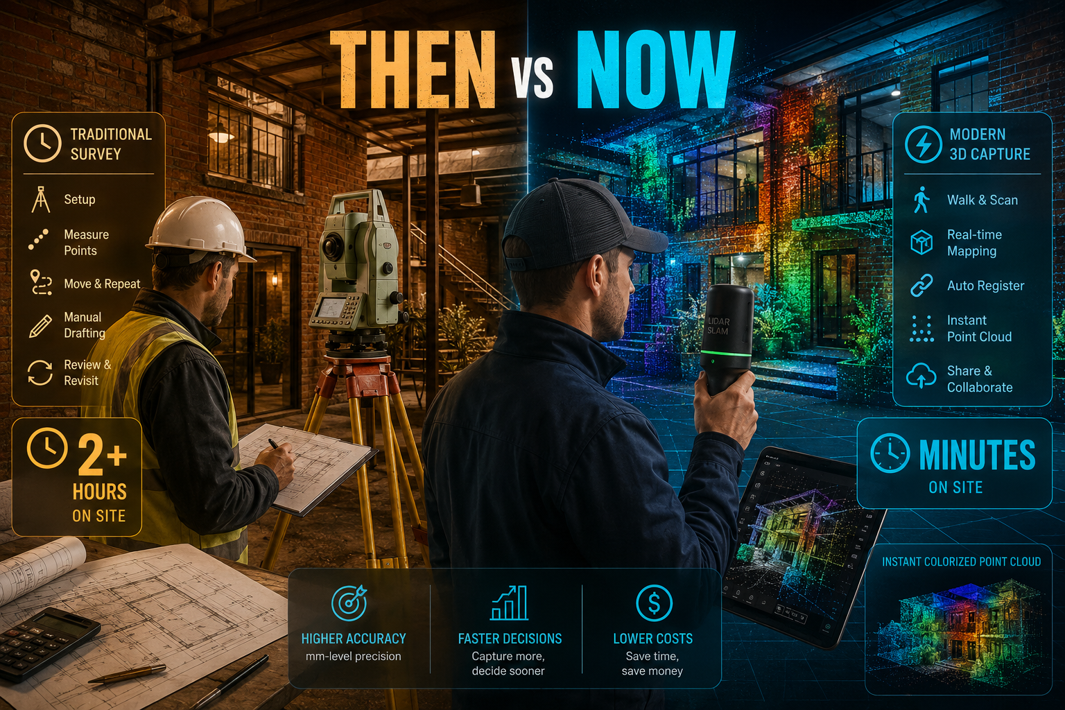
Traditional measured building surveys can take a team of two professionals an entire day to document a 500 m² commercial property — yet a modern handheld LiDAR scanner can capture the same space as a dense, accurate 3D point cloud in under 30 minutes. That gap is not a minor efficiency gain. It is a fundamental shift in how property professionals understand, document, and assess the built environment.
The Mobile 3D Mapping Revolution: Survey Anywhere with Handheld Systems for Indoor-Outdoor Property Assessments is reshaping the surveying industry in 2026. Compact, GPS-independent devices now allow chartered surveyors, building inspectors, and property managers to walk through any structure — from a listed Victorian terrace to a sprawling logistics warehouse — and generate a precise, colourised 3D replica in real time. This guide breaks down how these systems work, which devices lead the market, and what the practical benefits mean for property assessments of every kind.
Key Takeaways 📌
- Handheld SLAM LiDAR systems can capture millions of data points per second, producing accurate 3D models without GPS or fixed reference stations.
- Speed and cost savings are dramatic: surveys that once took days can be completed in hours, reducing labour costs significantly.
- Indoor-outdoor continuity is now seamless — modern devices transition between GPS-denied interiors and open exteriors without data gaps.
- Multiple property assessment types benefit, including building surveys, dilapidations, schedule of condition reports, and structural assessments.
- Integration with BIM and CAD workflows means 3D scan data flows directly into professional deliverables with minimal post-processing.
How Handheld 3D Mapping Systems Actually Work
SLAM Technology: The Engine Behind the Revolution
The core technology enabling portable 3D mapping is Simultaneous Localisation and Mapping (SLAM). Rather than relying on fixed ground control points or GPS signals, SLAM algorithms allow a device to build a map of its surroundings while simultaneously tracking its own position within that map. The result: a surveyor simply walks through a building, and the device does the rest.
💡 Pull Quote: "SLAM-powered handheld scanners have effectively removed the two biggest barriers to rapid 3D surveying: the need for GPS and the need for a static instrument setup."
Modern SLAM systems combine several sensor types:
- LiDAR (Light Detection and Ranging): Fires laser pulses and measures return times to calculate precise distances to surfaces.
- IMU (Inertial Measurement Unit): Tracks movement, orientation, and acceleration to maintain positional accuracy during motion.
- Cameras: Capture colour imagery that is fused with point cloud data to produce photorealistic 3D models.
The CHCNAV RS7, for example, integrates a tactical-grade IMU with real-time SLAM correction, achieving up to 1.15 million points per second and a 360° × 189° field of view, with dual 12MP HD cameras for colourised point cloud capture [1]. This level of density makes it ideal for complex indoor environments where fine detail matters.
From GPS-Denied Interiors to Open Exteriors — Without Stopping
One of the most significant practical advances is seamless indoor-outdoor transition. Earlier mobile mapping systems struggled when moving between GPS-available outdoor environments and GPS-denied interiors. Today's devices handle this automatically.
The Artec Jet supports seven deployment modes — handheld, drone, vehicle, and more — with a sensing range up to 300 metres and ±10 mm accuracy, making it equally capable in open fields and confined basement plant rooms [3]. The PRECISE S7 achieves a 99.9% fix rate using proprietary MLF-SLAM technology, ensuring reliable mapping even in challenging environments like airports and open plazas [4].
A recent study confirmed this capability, presenting a method that combines an aerial mapping system with a person-carried indoor positioning system to create seamless indoor-outdoor 3D models in real time — a workflow directly applicable to complex multi-building property assessments [8].
Comparing Leading Handheld 3D Mapping Devices in 2026
The market for handheld SLAM LiDAR systems has matured rapidly. The table below compares six leading devices across key performance metrics relevant to property survey applications.
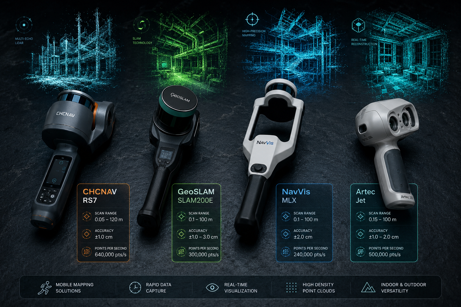
| Device | Points/Second | Range | Accuracy | Key Strength |
|---|---|---|---|---|
| CHCNAV RS7 | 1.15 million | Not specified | High | Dense indoor capture, dual cameras [1] |
| GeoSLAM SLAM200E 32L | 640,000 | 300 m | < 1 cm relative [6] | 32-channel LiDAR, outdoor range |
| NavVis MLX | High density | Not specified | High | Ergonomics, AEC/manufacturing focus [5] |
| Artec Jet | High density | 300 m | ±10 mm [3] | 7 deployment modes, versatility |
| PRECISE S7 | High density | Not specified | 99.9% fix rate [4] | Challenging environments |
| Carlson Scan3D | Moderate | Short-medium | Good | Pairs with iOS LiDAR, low entry cost [7] |
GeoCue's TrueView GO Series: A Workflow-First Approach 🔧
GeoCue's TrueView GO family — comprising the NEO, 116S, and 132S — takes a notably integrated approach. Rather than selling a scanner alone, GeoCue bundles LiDAR hardware, imaging, positioning, and LP360 point cloud processing software into a single workflow [2]. For property surveyors who need deliverables quickly, this end-to-end approach reduces the friction between data capture and final report.
The GeoSLAM SLAM200E 32L deserves special mention for outdoor property work. Its 32 laser channels and 640,000 points per second, combined with a 300-metre scanning range and relative accuracy of less than 1 cm, make it well-suited for large estate surveys, boundary assessments, and external facade documentation [6].
For teams with tighter budgets, the Carlson Scan3D offers an accessible entry point. It pairs with an Intel RealSense™ camera or a LiDAR-capable iOS device, enabling mobile 3D scanning without specialist hardware investment [7]. This democratisation of the technology is significant — it means smaller surveying practices can now offer 3D documentation services without capital expenditure on premium hardware.
The Mobile 3D Mapping Revolution in Property Assessments: Real-World Applications
Building Surveys and Structural Inspections
The most immediate application for the Mobile 3D Mapping Revolution: Survey Anywhere with Handheld Systems for Indoor-Outdoor Property Assessments is in detailed building surveys. A Level 3 building survey — the most comprehensive type — requires thorough documentation of every accessible element of a property. Handheld 3D scanning accelerates this process dramatically.
A surveyor conducting a RICS Level 3 building survey can use a handheld scanner to:
- ✅ Capture precise floor-to-ceiling heights and room dimensions in minutes
- ✅ Document crack patterns and wall deformations with millimetre-level accuracy
- ✅ Create a permanent 3D record of the property's condition at the time of survey
- ✅ Identify structural anomalies that might be missed in a visual-only inspection
For structural surveys, the ability to overlay point cloud data against design drawings immediately highlights deviations — a critical capability when assessing older properties where as-built conditions often diverge significantly from original plans.
Schedule of Condition Reports and Dilapidations
Schedule of condition reporting is a natural fit for handheld 3D mapping. These reports — typically prepared at the start of a lease to record a property's condition — benefit enormously from having an objective, measurable 3D baseline. When a lease ends and dilapidations are disputed, a point cloud captured at lease commencement provides irrefutable evidence of the property's original state.
A case study published in a peer-reviewed journal demonstrated how LiDAR instruments and BIM approaches can enhance the design, construction, and management processes of real estate assets — reducing disputes and improving asset management efficiency across entire portfolios [10].
For commercial property professionals, this integration with commercial property surveying workflows represents a step-change in the quality of evidence available during lease negotiations and dilapidations settlements.
Roof Surveys and Hard-to-Reach Areas 🏗️
Traditional roof surveys require physical access — scaffolding, cherry pickers, or at minimum a drone. Handheld SLAM scanners, particularly those with drone deployment modes like the Artec Jet, can capture complete roof geometry, slope angles, and surface conditions without putting surveyors at height.
Combined with drone surveys, handheld 3D mapping creates a complete picture: the drone captures the roof and upper facades while the handheld scanner documents interior spaces. The two datasets can be merged into a single coherent 3D model of the entire property.
Subsidence, Damp, and Specific Defect Investigations
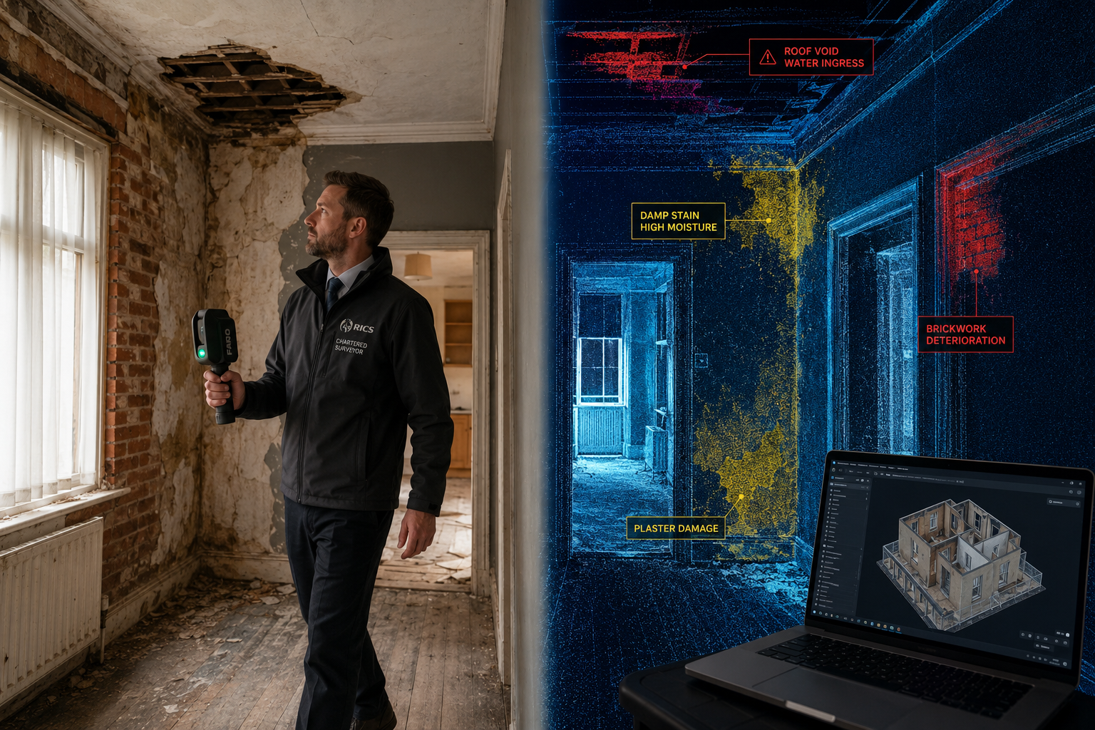
For targeted investigations — such as subsidence surveys or damp surveys — handheld 3D scanning provides precise spatial context for defect locations. Rather than describing a crack as "in the north-east corner of the ground floor," a surveyor can reference its exact coordinates within a georeferenced 3D model.
This precision is equally valuable for specific defect reports, where clients need to understand not just what is wrong, but exactly where it is, how extensive it is, and how it relates to the surrounding structure.
Speed and Cost: The Numbers That Matter
The business case for adopting handheld 3D mapping is compelling. A comprehensive review of mobile mapping systems highlighted the shift from traditional vehicle-based platforms to portable devices, noting that these advancements have substantially expanded 3D data collection capabilities while reducing operational complexity [9].
Time Savings: A Practical Comparison
| Task | Traditional Method | Handheld 3D Scanning |
|---|---|---|
| Measure and sketch 500 m² office | 4–6 hours | 20–40 minutes |
| Document facade of 3-storey building | 2–3 hours | 15–25 minutes |
| Full schedule of condition (commercial unit) | 1–2 days | 3–5 hours |
| Post-processing and drawing production | 1–2 days | 2–4 hours (automated) |
Cost Implications 💰
The time savings translate directly into reduced labour costs and faster project turnaround. For a surveying practice billing by the day, completing a schedule of condition in half the time either doubles capacity or reduces client costs — a powerful competitive advantage.
Hardware costs for entry-level systems like the Carlson Scan3D are accessible for small practices, while premium systems like the CHCNAV RS7 or NavVis MLX represent capital investments that pay back quickly on high-volume commercial work. The key calculation is straightforward: if a system saves four hours per survey and a practice completes 50 surveys per year, that is 200 hours of billable time recovered annually.
Integrating 3D Scan Data into Professional Survey Workflows
From Point Cloud to Deliverable
Raw point cloud data is only useful when it can be converted into professional deliverables. Modern handheld scanning workflows integrate with:
- AutoCAD and Revit: Point clouds can be imported directly, allowing surveyors to trace accurate floor plans, sections, and elevations.
- BIM (Building Information Modelling): Scan-to-BIM workflows are increasingly standard in commercial property management, enabling ongoing asset management from a single 3D model.
- Reporting software: Annotated screenshots from 3D models can be embedded directly into survey reports, providing clients with visual evidence that is far more compelling than photographs alone.
Quality Assurance and RICS Standards
Professional surveyors must ensure that 3D scan data meets the accuracy standards required for RICS-compliant reporting. Key considerations include:
- Relative vs. absolute accuracy: Most SLAM systems report relative accuracy (how consistent the model is internally) rather than absolute accuracy (how it aligns with real-world coordinates). For most property survey applications, relative accuracy of < 1 cm is sufficient.
- Data validation: Overlapping scan passes and loop closure algorithms help identify and correct drift errors in SLAM data.
- Documentation: The scanning methodology, device used, and accuracy specifications should be recorded and disclosed in survey reports.
Conclusion: Actionable Next Steps for Property Professionals
The Mobile 3D Mapping Revolution: Survey Anywhere with Handheld Systems for Indoor-Outdoor Property Assessments is not a future prospect — it is the present reality of professional surveying in 2026. The technology is proven, the hardware is accessible, and the workflow benefits are measurable.
For property professionals ready to adopt handheld 3D mapping, here are practical next steps:
-
Evaluate your survey volume and type. High-volume commercial practices will benefit most from premium systems like the CHCNAV RS7 or NavVis MLX. Smaller practices or those focused on residential work should explore the Carlson Scan3D or entry-level GeoSLAM options.
-
Pilot on a known property. Before deploying on a client project, scan a property you know well and compare the 3D output against existing drawings. This builds confidence in the data and identifies any workflow gaps.
-
Invest in processing software training. The scanner is only half the solution. Proficiency in LP360, Leica Cyclone, or Autodesk ReCap is essential for efficient post-processing.
-
Update your survey methodology documentation. RICS-compliant reports should disclose the technology used. Prepare a standard methodology statement for 3D scan-assisted surveys.
-
Communicate the value to clients. Clients who understand that their survey includes a permanent, accurate 3D record of their property's condition — not just a written report — will recognise the added value and be more willing to commission comprehensive assessments.
The days of clipboards, tape measures, and hand-drawn sketches are not entirely over, but they are numbered. Surveyors who embrace handheld 3D mapping now will be better positioned to deliver faster, more accurate, and more defensible property assessments — for every type of property, anywhere.
References
[1] latnet.ca – https://latnet.ca/products/rs7?utm_source=openai
[2] Handheld – https://geocue.com/sensors/handheld/?utm_source=openai
[3] Artec Jet – https://digitizedesigns.com/long-range-3d-scanners/artec-jet/?utm_source=openai
[4] Precise S7 – https://www.precise-geo.com/precise-s7/?utm_source=openai
[5] Products – https://www.navvis.com/products?utm_source=openai
[6] Geoslam – https://sicher-3d.com/geoslam/?utm_source=openai
[7] Carlson Scan3d – https://petrovasolutions.com/products/measurement-devices/carlson-scan3d/?utm_source=openai
[8] arxiv – https://arxiv.org/abs/2604.26368?utm_source=openai
[9] Pmc9185250 – https://pmc.ncbi.nlm.nih.gov/articles/PMC9185250/?utm_source=openai
[10] mdpi – https://www.mdpi.com/2076-3417/15/14/7638?utm_source=openai