{"cover":"Professional landscape format (1536×1024) hero image featuring bold text overlay '3D Laser Scanning and Reality Capture: Mainstream Tools for Accurate Property Mapping' in extra large 72pt white sans-serif font with dark shadow and semi-transparent navy overlay box, positioned center-upper third. Background shows surveyor operating handheld 3D laser scanner on construction site with visible point cloud data overlay on digital tablet, modern building framework, safety equipment, colorful point cloud visualization floating in space. Color scheme: deep blue, electric cyan, white, orange safety accents. High contrast, magazine cover quality, editorial style, professional surveying technology aesthetic, dynamic composition showing technology meeting construction reality","content":["Detailed landscape format (1536×1024) illustration showing hybrid capture workflow integration with three distinct zones: left third displays static terrestrial laser scanner on tripod capturing detailed architectural corner with sub-millimeter accuracy visualization (green precision indicators), center third shows surveyor with mobile SLAM backpack device walking through corridor with real-time point cloud trail forming behind them (blue trajectory lines), right third presents autonomous robotic scanner navigating space with confidence map overlay showing quality zones in heat map colors (green high confidence, yellow medium, red low). Text overlay 'Hybrid Workflows: TLS + SLAM + Robotics' in bold 48pt font, technical diagrams showing 3-5mm accuracy convergence, professional surveying aesthetic with clean infographic style, modern construction environment background","Detailed landscape format (1536×1024) split-screen comparison visual showing four key applications: top-left quadrant displays pre-construction baseline documentation with before/after building facade point clouds and litigation protection shield icon, top-right shows concrete floor contouring with colorful elevation heat map and contour lines overlaid on warehouse floor, bottom-left presents progressive construction phase capture with timeline showing MEP installations and reinforcement tracking across multiple dates, bottom-right illustrates integrated infrastructure modeling combining above-ground building scan with subsurface utility mapping in unified BIM model. Text overlay 'Real-World Applications Transforming Property Surveys' in 56pt bold font, professional icons, clean technical aesthetic, construction and surveying context, data visualization elements","Detailed landscape format (1536×1024) modern office scene showing small surveying firm team reviewing 3D scan data on large monitor displaying colorful point cloud of commercial property, diverse team of three professionals pointing at screen with excitement, foreground shows affordable handheld scanner device (Matterport Pro3 style) on desk with specifications callout showing '100m range, 20-second capture, automatic floor plans', background displays safety benefits infographic with hard hat icon and speed comparison chart showing traditional survey (5 days) versus 3D scanning (8 hours), tablet showing real-time quality feedback confidence map. Text overlay 'Accessible Technology for Small Firms' in 52pt bold font, professional photography style, warm lighting, technology democratization theme, cost-effective innovation aesthetic"]
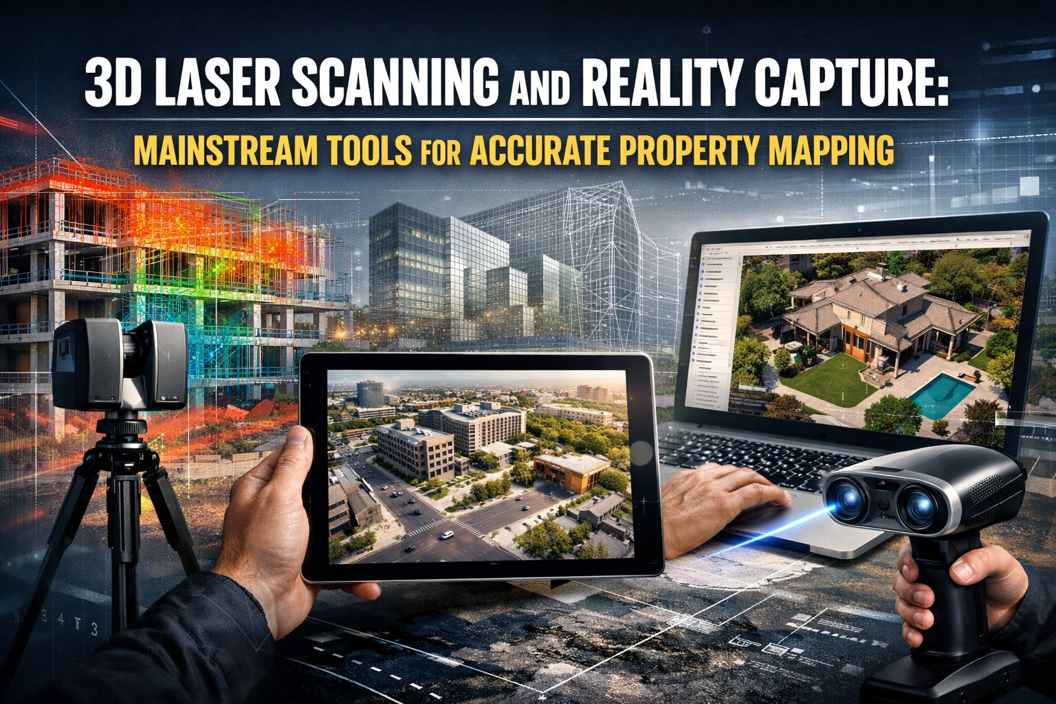
The construction industry has witnessed a remarkable transformation in 2026, as 3D Laser Scanning and Reality Capture: Mainstream Tools for Accurate Property Mapping have evolved from specialized technologies reserved for large corporations into accessible, user-friendly solutions that small surveying firms can deploy with confidence. What once required extensive training, expensive equipment, and dedicated specialists has become streamlined, affordable, and remarkably intuitive—fundamentally changing how properties are documented, analyzed, and developed.
This democratization of surveying technology represents more than just cost savings. It delivers unprecedented safety benefits by reducing the need for surveyors to access dangerous locations, accelerates project timelines from weeks to days, and provides millimeter-accurate documentation that protects all stakeholders from costly disputes. For chartered surveyors, property developers, and construction professionals, understanding how these mainstream tools deliver accurate property mapping has become essential for competitive advantage in 2026.
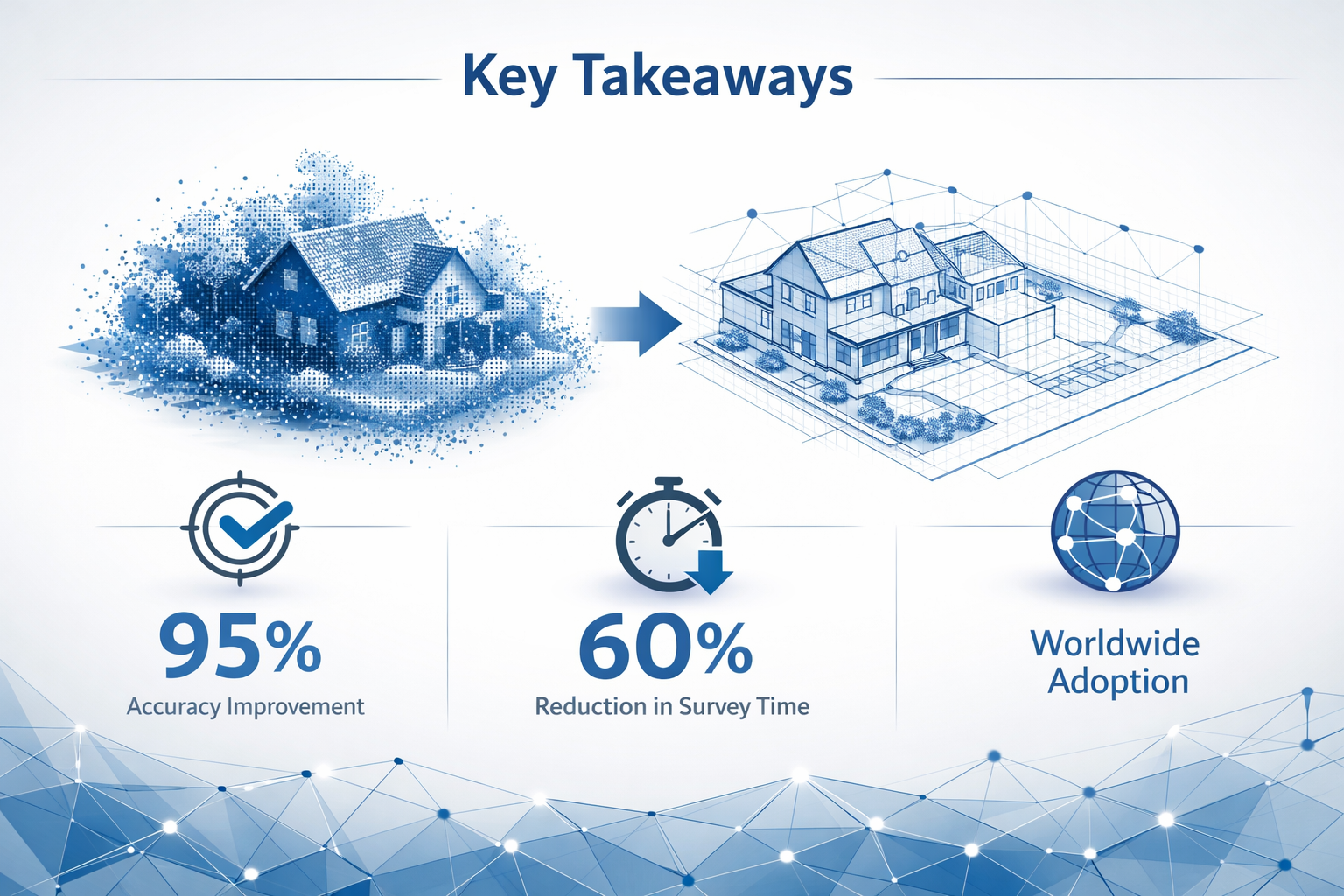
Key Takeaways
🎯 Hybrid capture workflows combining terrestrial laser scanning (TLS), mobile SLAM, and autonomous robotics deliver 3-5mm accuracy while dramatically reducing survey time and cost
📊 Real-time quality feedback systems built into 2026 scanners provide instant confidence maps, enabling operators to ensure complete coverage without post-processing surprises
💼 Small firms now access enterprise capabilities with devices capturing 100-meter ranges in under 20 seconds, automatically generating floor plans and measurements at affordable price points
⚖️ Litigation protection applications have emerged as critical use cases, with baseline documentation establishing indisputable digital records before adjacent construction begins
🚀 GPU-accelerated processing achieves 10x faster speeds, enabling same-day deliverables that integrate seamlessly with BIM workflows and client decision-making timelines
Understanding 3D Laser Scanning and Reality Capture Technology
What Makes 3D Laser Scanning Different from Traditional Surveying
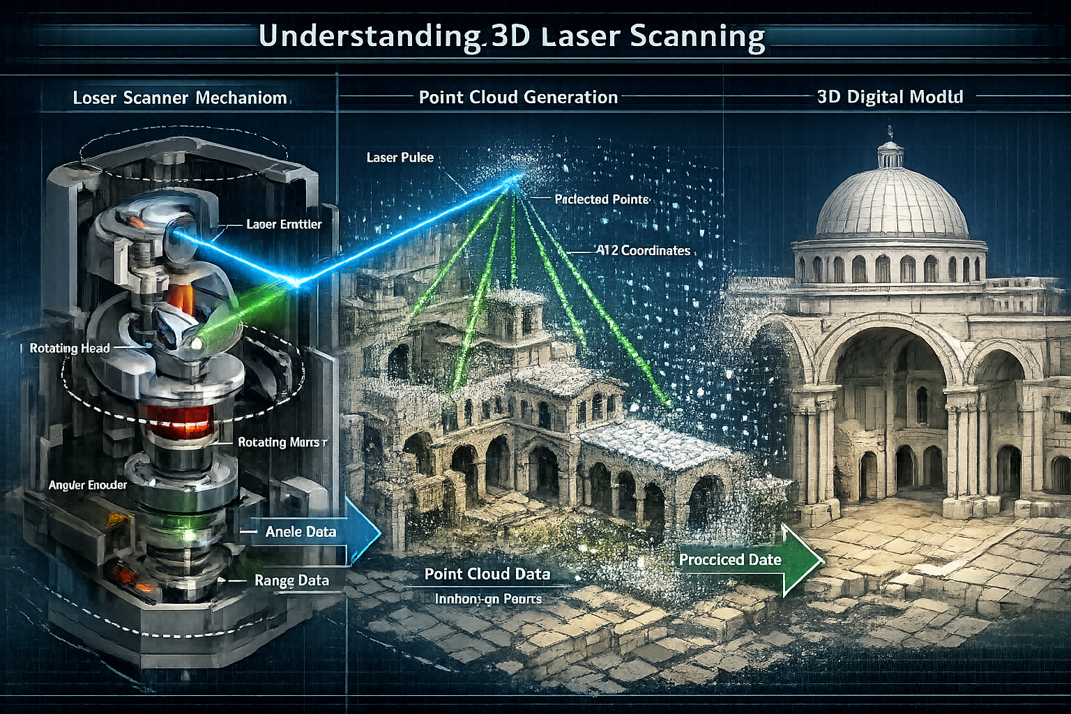
Traditional property surveying relies on manual measurements taken at strategic sampling points—typically every 10 feet along walls, corners, and key features. This approach, while proven over decades, introduces several limitations that become problematic in complex projects. Measurements capture only what the surveyor identifies as important in the moment, creating potential gaps in documentation that may prove critical later. The process is time-intensive, weather-dependent, and requires surveyors to access potentially dangerous locations like rooftops, scaffolding, or active construction zones.
3D laser scanning fundamentally changes this paradigm by capturing millions of data points across entire surfaces rather than selective samples. Modern scanners emit rapid laser pulses—often millions per second—that bounce off surfaces and return to the device, calculating precise distances based on time-of-flight measurements.[5] The result is a comprehensive "point cloud" representing every visible surface with millimeter accuracy, creating a complete digital twin of the physical environment.
The industry-standard accuracy for 3D laser scanning deployments ranges from 2-4mm, a precision level that traditional methods cannot match consistently across large areas.[1] This isn't merely about tighter tolerances—it's about comprehensive coverage that eliminates the guesswork inherent in sampling-based approaches. When a chartered building surveyor needs to document a complex Victorian property with irregular walls, ornate features, and multiple levels, 3D scanning captures every detail without subjective judgment about what matters.
The Evolution to Hybrid Capture Workflows
The surveying industry has moved beyond the "which scanner is best" debates that dominated previous years. In 2026, hybrid capture workflows have become the industry standard, integrating multiple capture modalities into unified survey strategies.[5] This evolution reflects a mature understanding that different technologies excel in different scenarios, and combining them delivers superior results to any single approach.
Static terrestrial laser scanning (TLS) establishes the geometric control network for projects requiring survey-grade accuracy. These tripod-mounted scanners provide sub-millimeter accuracy under 2mm locally, making them ideal for establishing precise reference points and capturing detailed architectural features.[5] However, their static nature means surveyors must set up multiple scan positions to achieve complete coverage, which can be time-consuming in large or complex environments.
Mobile SLAM (Simultaneous Localization and Mapping) technology addresses TLS's coverage limitations by enabling surveyors to walk through spaces while continuously capturing data. These handheld or backpack-mounted devices rapidly capture volumetric data at 5-20mm accuracy depending on environmental conditions.[5] While less precise than static TLS, mobile SLAM excels at quickly documenting large areas, corridors, and spaces where setting up multiple tripod positions would be impractical.
The breakthrough in 2026 workflows comes from advanced software registration algorithms that automatically detect and snap mobile SLAM trajectories to rigid TLS control scans.[5] This hybrid approach achieves approximately 3-5mm optimized accuracy by constraining SLAM drift to TLS control points—combining survey-grade global accuracy with rapid complete coverage.[5] For a building survey of a commercial property, this means surveyors can establish precise control points in key locations with TLS, then rapidly capture the entire interior with mobile SLAM, confident that the final registered dataset maintains survey-grade accuracy throughout.
Real-Time Quality Assurance and Multi-Layer Sensors
One of the most significant advances in 2026 technology is the integration of real-time quality feedback systems directly into capture devices. Operators now receive live "confidence maps" that alert them to feature-poor environments where drift is likely, enabling proactive loop closure or speed adjustments.[5] This immediate feedback transforms the capture process from a "hope and check later" approach to an assured quality workflow where surveyors know they have complete, accurate data before leaving the site.
Imagine a surveyor documenting a long, featureless corridor—a scenario where traditional SLAM systems struggle with drift due to lack of distinctive reference points. The 2026-generation device immediately displays a yellow or red confidence indicator, prompting the surveyor to slow down, create a loop closure by returning to a known point, or supplement with additional TLS control. This real-time awareness prevents the costly scenario of discovering incomplete or inaccurate data only after returning to the office.
Multi-layer LiDAR sensors in modern devices capture millions of points per second with significantly reduced noise, providing cleaner definition of sharp architectural features like door frames, pipes, and structural elements.[5] Earlier generation scanners often produced "fuzzy" edges around complex features, requiring manual cleanup during processing. The improved sensor technology in 2026 delivers cleaner raw data that requires less post-processing intervention, accelerating the path from capture to deliverable.
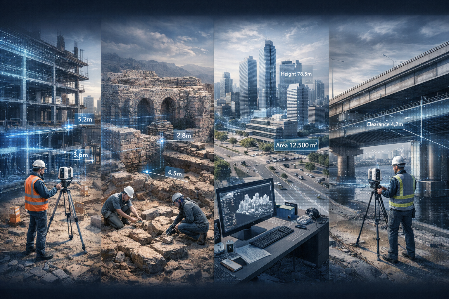
Real-World Applications of 3D Laser Scanning and Reality Capture for Property Mapping
Litigation Protection Through Pre-Construction Baseline Documentation
Property damage disputes between adjacent construction projects and existing buildings have historically relied on subjective assessments, photographs of questionable date authenticity, and conflicting expert testimony. The introduction of litigation protection through pre-construction baseline documentation has transformed this contentious landscape by creating indisputable digital records of existing conditions before adjacent construction begins.[1]
The 101 Federal Street case study demonstrates the power of this application. Before major construction commenced on an adjacent property, the building owner commissioned comprehensive 3D laser scanning to document every surface, crack, and architectural detail of the existing structure. When construction activities allegedly caused new damage, the owner could compare current conditions against the millimeter-accurate baseline scan, definitively establishing which damage pre-existed and which appeared post-construction.[1]
This application extends beyond high-value commercial properties. Small property owners facing nearby excavation, pile driving, or heavy construction can now affordably document their property's condition, creating defensible evidence for potential claims. For professionals conducting property inspections, offering pre-construction baseline scanning as a service provides clients with invaluable protection and creates recurring revenue opportunities.
The legal community has increasingly recognized 3D laser scan data as highly credible evidence. Unlike photographs that can be questioned regarding date, angle, or digital manipulation, point cloud data includes embedded metadata, GPS coordinates, and scan registration information that establishes authenticity and temporal accuracy. When disputes arise, expert witnesses can demonstrate changes with visual overlays that clearly show pre-existing versus new conditions—evidence that proves far more compelling to judges and juries than verbal descriptions or static photographs.
Concrete Floor Contouring and Construction Quality Control
Flat, level floors are critical for many construction applications, yet achieving and verifying flatness across large areas presents significant challenges. Traditional surveying methods sample elevation at grid points, creating a sparse dataset that may miss localized depressions or high spots between measurement locations. Concrete floor contouring using 3D laser scanning provides comprehensive full-floor elevation mapping with color contour lines and heat maps, reducing the risk of clashes, change orders, and delays on construction projects.[1]
Consider a warehouse development where the client requires FF/FL (Floor Flatness/Floor Levelness) specifications for automated guided vehicles. Traditional surveying might measure elevation every 10 feet, creating a grid with hundreds of data points. While this provides a general picture, it cannot definitively confirm compliance across every square foot. A 3D laser scan captures millions of elevation points across the entire floor surface, generating detailed contour maps that reveal every variation down to millimeter levels.
The visual output—typically a heat map with color gradients representing elevation changes—makes quality issues immediately apparent to all stakeholders. Areas that exceed tolerance limits appear in red, while compliant zones show green, creating an intuitive quality report that requires no specialized interpretation. This transparency benefits contractors who can identify and remediate issues before final inspection, and protects owners who receive documented proof of compliance.
Beyond initial construction, floor contouring proves valuable for specific defect surveys when investigating settlement, structural movement, or moisture-related issues. A retail facility experiencing drainage problems can use floor scanning to identify subtle slopes and depressions that funnel water to problem areas—issues that may be invisible to visual inspection but clearly revealed through elevation mapping.
Progressive Site Capture and Construction Phase Documentation
Construction projects involve hundreds of decisions based on current site conditions, with each trade building upon the work of previous contractors. Errors or deviations early in the sequence compound through subsequent phases, potentially creating costly rework or compromised functionality. Progressive site capture technology systematically documents each construction phase with detailed tracking of concrete reinforcements, MEP (mechanical, electrical, plumbing) installations, and milestone verification to ensure schedule compliance.[1]
The workflow begins with baseline scanning of existing conditions, establishing the reference against which all subsequent work is measured. As construction progresses, regular scanning—often weekly or at key milestones—captures each phase before it's concealed by subsequent work. This creates a comprehensive "as-built" record that shows exactly where reinforcement bars, conduits, pipes, and structural elements were installed, even after they're covered by concrete, drywall, or finishes.
This documentation proves invaluable when future modifications or repairs require knowledge of hidden infrastructure. A building owner planning a tenant improvement that requires new electrical runs can reference the as-built point clouds to identify existing conduit locations, avoiding costly exploratory demolition or accidental damage to concealed systems. For structural surveys investigating building issues, access to as-built scanning can reveal whether structural elements were installed as designed or if deviations may contribute to observed problems.
Progressive capture also enables powerful schedule verification capabilities. Project managers can compare actual construction progress against planned timelines by analyzing scan data to measure completed quantities, identify delayed areas, and provide objective evidence of progress for payment applications. This transparency benefits all parties—contractors receive fair compensation for completed work, while owners gain confidence that payments align with actual progress.
Integrated Infrastructure Modeling for Complex Developments
Large development projects must coordinate above-ground construction with complex subsurface infrastructure—utilities, drainage, foundations, and existing services that may be poorly documented or entirely unknown. Integrated infrastructure modeling combines above-ground and subsurface data through utility locating and 3D laser scanning to create comprehensive BIM models that provide a unified "single source of truth."[1]
The $255 million Doak Campbell Stadium renovation exemplifies this approach. The project required extensive modifications to a facility built over decades, with multiple construction phases creating a complex web of utilities, structural systems, and services—much of it undocumented or documented only in outdated drawings of questionable accuracy. The project team combined comprehensive utility locating with detailed 3D laser scanning to create an integrated model showing both above-ground architecture and subsurface infrastructure.[1]
This unified dataset enabled architects and contractors to design modifications with confidence, knowing exactly where existing utilities ran and how new systems could be routed without conflicts. The model revealed numerous discrepancies between original drawings and actual conditions—discoveries made during planning rather than during construction when they would have triggered expensive change orders and schedule delays.
For smaller projects, this integrated approach proves equally valuable. A commercial property undergoing renovation for RICS valuation purposes may require documentation of both the building structure and underground services for accurate assessment. Combining utility mapping with building scanning creates comprehensive documentation that supports accurate valuation and identifies potential issues that could affect property value.
How User-Friendly Technology Makes 3D Laser Scanning Accessible to Small Firms
Affordable Hardware with Enterprise Capabilities
The barrier to entry for 3D laser scanning has dropped dramatically, with 2026 bringing professional-grade capabilities to price points accessible to small surveying practices and independent professionals. Devices like the Matterport Pro3 exemplify this democratization, offering enhanced device range extending to 100 meters with capture times under 20 seconds per sweep, while automatically generating measurements and floor plans.[4] This represents a fundamental shift from earlier generations that required extensive manual post-processing to produce usable deliverables.
The economic calculation for small firms has shifted from "can we afford this technology" to "can we afford not to adopt it." A surveyor investing in a modern 3D scanning system can complete property documentation in hours rather than days, enabling higher project throughput with the same staff. The time savings alone often justify the investment within months, before considering the additional revenue opportunities from new service offerings like baseline documentation, floor contouring, or as-built modeling.
Operational simplicity has improved alongside affordability. Early laser scanning systems required specialized training, complex setup procedures, and deep technical knowledge to operate effectively. Modern devices feature intuitive touchscreen interfaces, automatic calibration, and guided workflows that enable surveyors to achieve professional results after minimal training. A practitioner familiar with traditional surveying methods can typically become proficient with current-generation 3D scanners within days rather than weeks or months.
This accessibility extends to data processing and deliverable creation. Cloud-based processing platforms automatically register scans, generate floor plans, create virtual tours, and extract measurements—tasks that previously required dedicated specialists using complex desktop software. A small firm can now offer comprehensive 3D documentation services without hiring specialized technicians or investing in expensive processing infrastructure.
Safety Benefits That Protect Surveyors and Reduce Liability
The safety advantages of 3D laser scanning extend beyond obvious scenarios like avoiding rooftop access or scaffolding work. Comprehensive remote capture enables surveyors to document hazardous environments—active construction zones, structurally compromised buildings, or contaminated sites—from safe distances or with minimal exposure time. A surveyor can capture a complete building exterior from ground level, eliminating the need to climb ladders or access unstable areas to measure upper-level features.
For damp surveys or investigations of potentially unstable structures, 3D scanning enables thorough documentation with reduced time inside compromised buildings. A surveyor can quickly capture comprehensive data, then conduct detailed analysis from the safety of their office, returning to the site only if specific areas require closer physical inspection. This approach minimizes exposure to structural hazards, mold, or other health risks while ensuring complete documentation.
The liability protection extends to the firm itself. Traditional surveying methods that rely on manual measurements and subjective observations can be challenged if disputes arise about what was or wasn't documented. A comprehensive 3D scan creates an objective, complete record that protects the surveyor from claims that critical features were missed or inadequately documented. When conducting homebuyer surveys, the ability to reference the complete point cloud dataset months or years later provides powerful protection against professional liability claims.
Insurance providers have begun recognizing these safety and liability benefits, with some offering reduced professional liability premiums for firms that incorporate 3D scanning into their standard workflows. The combination of improved surveyor safety and reduced claim exposure creates a compelling business case beyond the direct operational benefits.
Speed Advantages That Transform Project Economics
The time compression enabled by modern 3D scanning technology fundamentally changes project economics and client expectations. A traditional measured survey of a complex commercial property might require multiple site visits over several days, with additional time for manual drafting and quality checking. The same property can now be comprehensively captured in a single session lasting hours, with automated processing delivering floor plans, elevations, and 3D models within 24 hours.
This speed advantage creates multiple business benefits. Faster turnaround enables surveyors to serve more clients with existing resources, directly increasing revenue potential. Reduced site time minimizes disruption for occupied properties and reduces coordination requirements for accessing secure facilities. Same-day deliverables support accelerated decision-making for clients evaluating acquisition, renovation, or development opportunities.
The competitive implications are significant. Clients increasingly expect rapid turnaround for property documentation, particularly in fast-moving commercial transactions where delays can jeopardize deals. A surveying firm that can deliver comprehensive documentation in days rather than weeks gains substantial competitive advantage, particularly for time-sensitive projects like lease extension valuations or acquisition due diligence.
GPU-accelerated processing achieves 10x faster speeds compared to alternative photogrammetry software, enabling hybrid approaches that seamlessly combine aerial and terrestrial photography with laser scan data in single projects.[3] Software platforms like RealityCapture exemplify this capability, processing massive datasets that would have required days or weeks of computation into deliverables ready within hours. This processing speed enables surveyors to offer same-day or next-day deliverables that were simply impossible with earlier technology generations.
Integration with Existing Workflows and BIM Platforms
Technology adoption fails when new tools create isolated data silos or require complete workflow overhauls. Successful 3D scanning implementation in 2026 relies on seamless integration with existing surveying workflows and Building Information Modeling (BIM) platforms that clients increasingly expect. Modern scanning solutions export data in industry-standard formats—IFC, DWG, RVT, and others—that integrate directly into architectural, engineering, and construction software without conversion headaches.
For firms conducting building surveys, the integration workflow typically begins with field capture using hybrid TLS and mobile SLAM approaches. The raw point cloud data uploads to cloud processing platforms that automatically register scans and generate preliminary deliverables. Surveyors then refine these outputs—adding annotations, extracting specific measurements, or creating detailed CAD drawings—using familiar software tools enhanced with point cloud viewing capabilities.
The ability to reference the complete point cloud while creating traditional deliverables represents a significant quality improvement. Rather than relying on field notes and photographs to resolve ambiguities during drafting, surveyors can directly measure any feature from the point cloud data, ensuring accuracy and completeness. This reference capability proves particularly valuable for complex or irregular buildings where traditional measurement approaches struggle to capture three-dimensional relationships.
Client deliverables can range from simple floor plans and elevation drawings to sophisticated BIM models populated with parametric objects. The level of detail scales to project requirements and budget, with basic documentation requiring minimal post-processing while detailed BIM models involve more extensive modeling work. This flexibility enables firms to serve diverse client needs, from residential homebuyer surveys requiring simple floor plans to complex commercial developments demanding full BIM integration.
Best Practices for Implementing 3D Laser Scanning in Your Surveying Practice
Selecting the Right Equipment for Your Service Mix
The diversity of 3D scanning technologies available in 2026 requires thoughtful evaluation to match equipment capabilities with your firm's specific service offerings and client base. Static terrestrial laser scanners remain the gold standard for projects requiring survey-grade accuracy—boundary surveys, monitoring applications, or detailed architectural documentation where millimeter precision matters. These systems represent higher investment but deliver unmatched accuracy and range.
Mobile SLAM devices offer superior efficiency for interior documentation, building surveys, and projects where 5-10mm accuracy suffices. The ability to walk through spaces while continuously capturing data dramatically reduces field time compared to static scanning, making mobile systems ideal for large buildings, multi-floor properties, or projects with tight deadlines. Many successful firms adopt a hybrid equipment strategy, maintaining both static and mobile systems to optimize workflows based on project requirements.
Handheld scanners occupy an emerging middle ground, offering portability and ease of use for smaller projects or supplemental capture. These devices excel for documenting individual rooms, specific building features, or small properties where deploying larger systems would be inefficient. The lower price points make handheld scanners accessible entry points for firms beginning to explore 3D scanning capabilities.
Consider your typical project profile when evaluating equipment. A practice focused on residential surveys and reinstatement valuations may find handheld or mobile systems sufficient, while firms serving commercial clients with demanding accuracy requirements may need to invest in static TLS capabilities. Many equipment providers offer rental or lease options that enable firms to test technologies before committing to purchase, reducing adoption risk.
Training and Skill Development for Survey Teams
Technology alone doesn't guarantee successful implementation—your team must develop both technical proficiency with equipment and strategic understanding of when and how to apply 3D scanning effectively. Structured training programs should address three levels: basic operation (capturing quality data in the field), data processing (creating deliverables from point clouds), and strategic application (identifying projects where scanning delivers maximum value).
Field capture training focuses on practical skills—setting up equipment, planning scan positions for complete coverage, recognizing and addressing quality issues in real-time, and safely operating equipment in diverse environments. The real-time quality feedback systems in 2026 devices significantly reduce the learning curve, but surveyors still need to understand fundamental concepts like scan density, overlap requirements, and control point placement.
Data processing skills range from basic (using automated cloud platforms to generate standard deliverables) to advanced (creating detailed BIM models or performing complex analysis). Most firms benefit from developing tiered expertise, with all surveyors capable of basic operations while select team members develop advanced modeling capabilities. This approach ensures efficient resource allocation while maintaining quality standards.
Strategic training addresses the business dimension—recognizing opportunities where 3D scanning creates value, effectively communicating benefits to clients, and pricing services appropriately. A surveyor who understands that pre-construction baseline documentation protects clients from litigation risk can proactively recommend this service, creating revenue opportunities while delivering genuine client value.
Quality Control and Deliverable Standards
Establishing clear quality control protocols ensures consistent deliverable quality as your firm scales 3D scanning services. Field QC procedures should verify complete coverage before leaving the site, checking that all required areas were captured with adequate overlap and that scan quality meets project requirements. The real-time confidence mapping in modern devices facilitates this verification, but surveyors should still follow systematic checklists to ensure nothing is missed.
Processing QC involves verifying scan registration accuracy, checking for errors or artifacts in the point cloud data, and ensuring deliverables meet specified accuracy tolerances. Many firms implement peer review processes where a second surveyor checks critical deliverables before client delivery, catching potential issues before they impact client relationships.
Establishing deliverable standards creates consistency across projects and surveyors. Define standard formats for floor plans, elevation drawings, and 3D models, including layer conventions, annotation styles, and file naming protocols. This standardization improves efficiency (surveyors don't reinvent approaches for each project) and quality (clients receive consistent deliverables regardless of which team member handled the project).
Documentation of your QC processes provides valuable protection for professional liability purposes. When conducting RICS building surveys, documented QC procedures demonstrate professional diligence and provide evidence of appropriate care if questions arise about deliverable accuracy or completeness.
Pricing Strategies and Client Communication
Pricing 3D scanning services requires balancing multiple factors: equipment costs, field time, processing time, deliverable complexity, and market positioning. Many firms initially underprice scanning services, focusing on equipment cost recovery while undervaluing the speed, accuracy, and risk reduction benefits that justify premium pricing.
Value-based pricing focuses on client outcomes rather than cost-plus calculations. A pre-construction baseline scan that protects a property owner from potential six-figure damage claims delivers value far exceeding the surveyor's time and equipment costs. Pricing based on this protection value—rather than simply hours and expenses—enables firms to capture fair compensation while remaining competitive with the alternative (no protection at all).
Communicating value effectively requires educating clients about capabilities they may not know exist. Many property owners and developers remain unaware that affordable 3D scanning can document their property with millimeter accuracy, create virtual tours for remote stakeholders, or generate comprehensive as-built records. Proactive education through case studies, demonstration projects, and consultative selling approaches helps clients understand how scanning addresses their specific challenges.
Consider offering tiered service packages that provide entry points at various price levels. A basic package might include point cloud data and simple floor plans, while premium packages add detailed BIM models, virtual reality walkthroughs, or ongoing monitoring services. This structure enables clients to select appropriate service levels while creating upsell opportunities as they experience the value of basic services.
Future Trends and Emerging Capabilities in Reality Capture
Autonomous Robotic Scanning and AI-Assisted Analysis
The integration of autonomous robotic platforms represents the next frontier in reality capture efficiency. These systems navigate spaces independently, planning optimal scan positions and executing complete building documentation with minimal human intervention. While human operators remain essential for complex projects requiring judgment and adaptation, autonomous systems excel at routine documentation tasks like regular monitoring, progress tracking, or standard property surveys.
Artificial intelligence integration is transforming point cloud analysis from manual measurement extraction to automated feature recognition and classification. AI algorithms can automatically identify and classify building elements—walls, doors, windows, structural components—enabling rapid BIM model generation with minimal manual modeling. These capabilities are particularly valuable for large or complex projects where manual modeling would require prohibitive time investment.
Machine learning systems are also improving defect detection capabilities, automatically identifying potential issues like surface deviations, plumbness problems, or dimensional discrepancies that might escape visual inspection. For dilapidation surveys or condition assessments, AI-assisted analysis can flag areas requiring closer investigation, enabling surveyors to focus expertise where it delivers maximum value.
Enhanced Visualization and Client Engagement Tools
The evolution from technical point cloud data to compelling visualization experiences is accelerating client adoption and understanding. Virtual reality (VR) and augmented reality (AR) applications enable stakeholders to "walk through" properties remotely, experiencing spaces with realistic scale and detail impossible through photographs or traditional drawings. This capability proves particularly valuable for international clients, remote stakeholders, or projects where physical site visits are impractical.
Digital twin platforms extend beyond static documentation to create living models that integrate real-time sensor data, maintenance records, and operational information. A commercial property owner can reference the digital twin to locate specific building systems, review maintenance history, plan modifications, or respond to emergencies—all from a comprehensive 3D interface that provides intuitive spatial context.
These enhanced visualization capabilities create new service opportunities for surveying firms. Offering virtual tour creation, VR experiences, or digital twin development adds value beyond traditional documentation while differentiating firms in competitive markets. The technology barriers for these services continue declining, making them increasingly accessible to firms of all sizes.
Integration with IoT and Continuous Monitoring Applications
The convergence of reality capture with Internet of Things (IoT) sensors enables continuous monitoring applications that extend beyond one-time documentation to ongoing condition assessment. Strategic placement of sensors—measuring movement, vibration, temperature, or moisture—combined with periodic 3D scanning creates comprehensive monitoring systems that detect changes over time with millimeter precision.
For structures adjacent to major construction projects, continuous monitoring provides early warning of movement or damage, enabling proactive intervention before minor issues become major problems. The baseline 3D scan establishes the reference condition, while periodic rescanning quantifies any changes, and IoT sensors provide continuous data between scanning intervals.
Structural health monitoring applications are expanding beyond bridges and critical infrastructure to commercial and residential properties. A historic building undergoing renovation can be monitored throughout construction to ensure that work doesn't compromise structural integrity, with any unexpected movement triggering immediate investigation. This proactive approach protects both the property and the construction team from catastrophic failures.
Conclusion: Embracing the Mainstream Reality of 3D Laser Scanning
The transformation of 3D Laser Scanning and Reality Capture: Mainstream Tools for Accurate Property Mapping from specialized niche technology to accessible mainstream capability represents one of the most significant advances in surveying practice in decades. The convergence of affordable hardware, user-friendly software, hybrid workflows, and real-time quality assurance has eliminated the traditional barriers that kept these powerful tools out of reach for small and medium-sized practices.
The benefits extend across multiple dimensions: safety improvements that protect surveyors from hazardous environments, speed advantages that compress project timelines from weeks to days, accuracy enhancements that deliver millimeter precision across complete properties rather than sampled points, and documentation capabilities that protect clients from litigation risk while supporting informed decision-making.
For surveying professionals evaluating whether to adopt 3D scanning technology, the question has shifted from "should we" to "how quickly can we implement." The competitive landscape increasingly favors firms that can deliver rapid, comprehensive, accurate documentation, while clients have come to expect capabilities that were considered cutting-edge just years ago. Early adopters gain market positioning advantages, develop expertise while competition remains limited, and establish service offerings that create recurring revenue streams.
Actionable Next Steps
For firms beginning their 3D scanning journey:
- Evaluate your service mix to identify high-value applications where scanning delivers clear client benefits—pre-construction baselines, as-built documentation, or complex property surveys
- Start with rental or trial programs to test equipment and workflows before committing to major equipment investments
- Develop pilot projects with existing clients who value innovation and can provide feedback on deliverables and service value
- Invest in training for select team members who will champion adoption and develop expertise
- Document case studies that demonstrate value delivery, creating marketing materials for broader client education
For firms with existing scanning capabilities:
- Optimize hybrid workflows that combine static TLS, mobile SLAM, and emerging autonomous platforms for maximum efficiency
- Expand service offerings into emerging applications like continuous monitoring, digital twins, or VR experiences
- Refine pricing strategies to capture value based on client outcomes rather than cost-plus calculations
- Strengthen quality control processes to ensure consistent deliverable quality as project volume scales
- Build strategic partnerships with architects, contractors, and developers who can benefit from integrated reality capture services
The mainstream adoption of 3D laser scanning and reality capture tools has fundamentally changed what's possible in property documentation and analysis. Firms that embrace these capabilities position themselves at the forefront of an industry transformation, delivering superior value to clients while building sustainable competitive advantages. The technology has arrived, the business case is proven, and the opportunity is now.
References
[1] Four Applications Of Reality Capture From Gprs 3d Laser Scanning – https://www.gp-radar.com/article/four-applications-of-reality-capture-from-gprs-3d-laser-scanning
[2] Benefits Of 3d Laser Scanning – https://eagle-eac.com/benefits-of-3d-laser-scanning/
[3] Realitycapture – https://www.thefuture3d.com/software/realitycapture/
[4] 10 Ways 3d Scanner Technology Leads Efficiencies Surveying – https://matterport.com/blog/10-ways-3d-scanner-technology-leads-efficiencies-surveying
[5] 3d Laser Scanning In 2026 Major Technology And Workflow Shifts – https://www.enginyring.com/en/blog/3d-laser-scanning-in-2026-major-technology-and-workflow-shifts